|
search place name
|
||
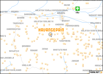
Hāvang-e Pā'īn (Khorāsān, Iran)Hāvang-e Pā'īn is a town in the Khorāsān region of Iran. An overview map of the region around Hāvang-e Pā'īn is displayed below.
regional and 3d topo map of Hāvang-e Pā'īn, Iran ::
Hāvang-e Pā'īn airports ::
The nearest airport is XBJ - Birjand, located 12.9 km north east of Hāvang-e Pā'īn.
Nearby towns ::
Samū (0.7km south) //
Margh (0.8km south) //
Mazār (0.9km south) //
Bāgh-e Tak (0.9km south east) //
Cheshmeh-ye Morteẕá (1.3km south east) //
Sar-e Razk (1.3km south west) //
Naşrābād (1.4km south east) //
Hāvang-e Bālā (1.4km north east) //
Sāj (1.6km south) //
Sar-e Zar (1.6km south west) //
Tag-e Khārū (1.8km south east) //
Cheshmeh-ye Zamānī (1.8km south east) //
Khūnīk (2.0km south east) //
Dezak (2.0km east) //
Tak-e Ārgīnī (2.3km north) //
Chahār Kesh (2.1km north east) //
Kāseh Sangī (2.5km north) //
Bāgh-e Dahaneh (2.6km north) //
Manz̧arīyeh (2.6km north) //
Chahār-e Bālā (2.7km north) //
Sorkhāb (2.8km west) //
‘Alīshāh (2.9km west) //
Zīgū'ī (2.9km west) //
Ḩoseynābād (3.4km north east) //
Roqū'ī (3.4km north east) //
Yosht (3.5km north east) //
Darreh-ye Pā'īn (3.5km north east) //
Jow Darāb (3.4km east) //
Band Darreh (3.6km east) //
[all distances 'as the bird flies' and approximate] 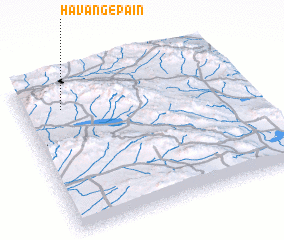 Places with similar names to Hāvang-e Pā'īn, Iran :: Disclaimer :: Information on this page comes without warranty of any kind |
||
|
Where is Hāvang-e Pā'īn? Elevation and coordinates ::
Latitude (lat): 32°48'23"N Longitude (lon): 59°10'50"E
Elevation (approx.): 1881m (map arrows pan, magnifying glasses zoom) |
||
|
Visiting Hāvang-e Pā'īn? Hotel/Accommodation ::
Book a hotel in Hāvang-e Pā'īn Travel Guide ::
Buy a travel guide for Iran rental cars ::
car rental offers GPS waypoint ::
download a GPX waypoint (PoI) of Hāvang-e Pā'īn for your GPS receiver
|
||