|
search place name
|
||
Hengūyeh (Hormozgān, Iran)Hengūyeh is a town in the Hormozgān region of Iran. An overview map of the region around Hengūyeh is displayed below.
regional and 3d topo map of Hengūyeh, Iran ::

Hengūyeh airports ::
The nearest airport is KIH - Kish Island, located 60.2 km south of Hengūyeh.
Other airports nearby include BDH - Bandar Lengeh (100.6 km south east), DXB - Dubai Intl (242.6 km south east), SHJ - Sharjah Intl (244.8 km south east), RKT - Ras Al Khaimah Intl (251.2 km south east), Nearby towns ::
Mardān (1.2km west) //
Deh Now-e Qalandarān (2.1km north west) //
‘Ālī Aḩmadān (2.2km north west) //
Tīrūdeh (2.8km south east) //
Khamār-e Qalandarān (4.1km west) //
Gezeh (5.1km east) //
Gachūyeh (6.0km south) //
Kūhvār (8.0km north west) //
Dārbast (10.3km south east) //
[all distances 'as the bird flies' and approximate] 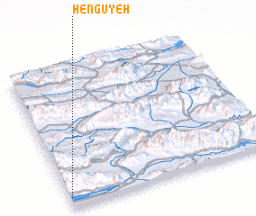 Places with similar names to Hengūyeh, Iran ::
// Hengū'īyeh (IR)
// Hengū'īyeh (IR)
// Henkū'īyeh (IR)
// Honkū'īyeh (IR)
// Huancaya (PE)
// Huancaye (PE)
// Huancayo (PE)
// Huancayo (PE)
// Huincaya (PE)
// Huncaya (PE)
Disclaimer :: Information on this page comes without warranty of any kind |
||
|
Where is Hengūyeh? Elevation and coordinates ::
Latitude (lat): 27°4'7"N Longitude (lon): 54°0'30"E
Elevation (approx.): 336m (map arrows pan, magnifying glasses zoom) |
||
|
Visiting Hengūyeh? Hotel/Accommodation ::
Book a hotel in Hengūyeh Travel Guide ::
Buy a travel guide for Iran rental cars ::
car rental offers GPS waypoint ::
download a GPX waypoint (PoI) of Hengūyeh for your GPS receiver
|
||