|
search place name
|
||
Jal Khān (Golestān, Iran)Jal Khān is a town in the Golestān region of Iran. An overview map of the region around Jal Khān is displayed below.
regional and 3d topo map of Jal Khān, Iran ::
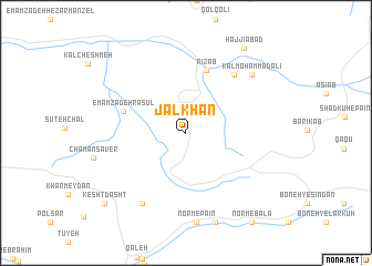
Nearby towns ::
Emāmzādeh Rasūl (5.5km north west) //
Rīz Āb (6.6km north) //
Ḩoseynjān (7.0km north east) //
Boneh-ye Sīāh Chapal (8.0km south west) //
Kal Moḩammad‘alī (7.9km north east) //
Ḩājjīābād (9.8km north east) //
Kesht Dasht (9.7km south west) //
[all distances 'as the bird flies' and approximate] 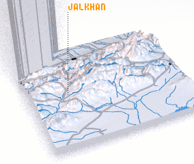 Places with similar names to Jal Khān, Iran ::
// Jallo Khān (PK)
// Gel'khen (RU)
Disclaimer :: Information on this page comes without warranty of any kind |
||
|
Where is Jal Khān? Elevation and coordinates ::
Latitude (lat): 36°32'51"N Longitude (lon): 54°16'24"E
Elevation (approx.): 2375m (map arrows pan, magnifying glasses zoom) |
||
|
Visiting Jal Khān? Hotel/Accommodation ::
Book a hotel in Jal Khān Travel Guide ::
Buy a travel guide for Iran rental cars ::
car rental offers GPS waypoint ::
download a GPX waypoint (PoI) of Jal Khān for your GPS receiver
|
||