|
search place name
|
||
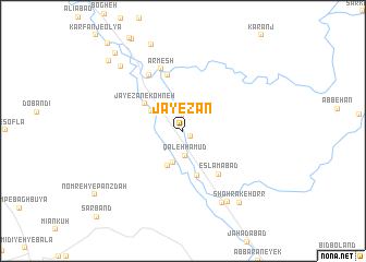
Jāyezān (Khūzestān, Iran)Jāyezān is a town in the Khūzestān region of Iran. An overview map of the region around Jāyezān is displayed below.
regional and 3d topo map of Jāyezān, Iran ::
Jāyezān airports ::
The nearest airport is MRX - Bandar Mahshahr Mahshahr, located 75.8 km south west of Jāyezān.
Other airports nearby include AWZ - Ahwaz (115.2 km north west), QMJ - Masjed Soleiman Shahid Asyaee (135.7 km north west), ABD - Abadan (165.3 km west), BUZ - Bushehr (235.0 km south east), Nearby towns ::
Sūlakī (0.8km south east) //
Deh Şafar (1.5km north) //
Deh Valī (2.4km north west) //
Qal‘eh Ḩamūd (2.6km south) //
Mārūn (3.3km south) //
Towlshīrī (3.4km north west) //
Shahrak-e Salmān (3.9km south) //
Jāyezān-e Kohneh (4.3km north west) //
Chamlā (4.8km south) //
Eslāmābād (5.4km south east) //
Shahrak-e Āzādī (5.8km north) //
Haft Tappeh (6.4km north west) //
Ārmesh (6.6km north) //
Dehnow (8.1km south east) //
Jūlakī (8.3km south east) //
Sīāh Gel (8.6km north west) //
Shahrak-e Balāl (8.9km south east) //
Shahrak-e Ḩorr (8.9km south east) //
Kohleh-ye Yek (9.3km north) //
Emām Reẕā (9.7km north west) //
Kombordeh (9.9km north west) //
Sar Band (11.6km south west) //
[all distances 'as the bird flies' and approximate] 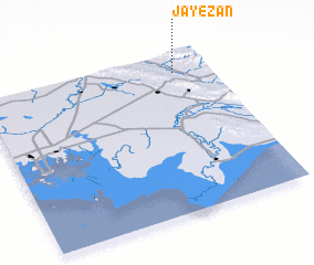 Places with similar names to Jāyezān, Iran ::
// Gyosan (MM)
Disclaimer :: Information on this page comes without warranty of any kind |
||
|
Where is Jāyezān? Elevation and coordinates ::
Latitude (lat): 30°52'57"N Longitude (lon): 49°50'51"E
Elevation (approx.): 160m (map arrows pan, magnifying glasses zoom) |
||
|
Visiting Jāyezān? Hotel/Accommodation ::
Book a hotel in Jāyezān Travel Guide ::
Buy a travel guide for Iran rental cars ::
car rental offers GPS waypoint ::
download a GPX waypoint (PoI) of Jāyezān for your GPS receiver
|
||