|
search place name
|
||
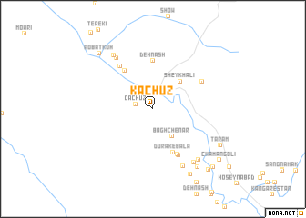
Kachūz (Chahār Maḩāll va Bakhtīār, Iran)Kachūz is a town in the Chahār Maḩāll va Bakhtīār region of Iran. An overview map of the region around Kachūz is displayed below.
regional and 3d topo map of Kachūz, Iran ::
Kachūz airports ::
The nearest airport is QMJ - Masjed Soleiman Shahid Asyaee, located 72.6 km south west of Kachūz.
Other airports nearby include AWZ - Ahwaz (154.7 km south west), MRX - Bandar Mahshahr Mahshahr (206.1 km south), ABD - Abadan (268.6 km south west), Nearby towns ::
Gachūz (1.8km west) //
Bāgh Chenār (3.9km south east) //
Sheykh ‘Ālī (4.4km north east) //
Keserīz̄ (5.5km north west) //
Dūrak-e Bālā (5.7km south) //
Dehnāsh (5.9km north) //
Dūrak-e Pā'īn (6.2km south east) //
Khīār Kāl (6.3km south east) //
Teyak (6.3km north west) //
Tepāh (6.1km north east) //
Bāgh-e Kārī (7.3km north west) //
Bāzgarūn (7.7km south east) //
Hūshūt (7.8km north west) //
Cham Qal‘eh-ye Bālā (7.9km south east) //
Arteh (7.8km south east) //
Feryak (8.5km south east) //
Tabarak-e Pā'īn (8.9km south east) //
Ţāram (8.3km south east) //
Robāţ Kūh (8.8km north west) //
Cham Qal‘eh-ye Pā'īn (9.5km south east) //
Sar Khalā (9.5km south east) //
Chaman Golī (9.3km south east) //
[all distances 'as the bird flies' and approximate]  Places with similar names to Kachūz, Iran ::
Disclaimer :: Information on this page comes without warranty of any kind |
||
|
Where is Kachūz? Elevation and coordinates ::
Latitude (lat): 32°16'41"N Longitude (lon): 49°58'7"E
Elevation (approx.): 2079m (map arrows pan, magnifying glasses zoom) |
||
|
Visiting Kachūz? Hotel/Accommodation ::
Book a hotel in Kachūz Travel Guide ::
Buy a travel guide for Iran rental cars ::
car rental offers GPS waypoint ::
download a GPX waypoint (PoI) of Kachūz for your GPS receiver
|
||