|
search place name
|
||
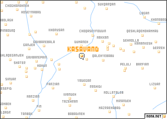
Kasāvand (Lorestān, Iran)Kasāvand is a town in the Lorestān region of Iran. An overview map of the region around Kasāvand is displayed below.
regional and 3d topo map of Kasāvand, Iran ::
Kasāvand airports ::
The nearest airport is QMJ - Masjed Soleiman Shahid Asyaee, located 182.0 km south of Kasāvand.
Nearby towns ::
Gelīgerd (0.6km east) //
Shūrcheh (2.4km north) //
Dūmaneh (3.1km north) //
Qal‘eh-ye Bābū (3.6km east) //
Yādegār (5.7km south) //
Darreh Bāgh (5.7km south) //
Şeydābād (4.7km west) //
Choqā Seyf od Dīn (5.7km north) //
Modābād (5.0km south west) //
Farqas (5.1km north east) //
Makkān (5.4km north east) //
Qal‘eh-ye Ḩājj Manşūr (5.3km north east) //
Qal‘eh-ye Ḩeydar (6.0km north east) //
Deh Sīāh (6.0km west) //
Chahār Cheshmeh (6.4km north east) //
Rashīdī (7.3km south) //
Khorūsān (7.7km north west) //
Qal‘eh-ye Zakī (7.3km east) //
Īvandeh (9.1km south) //
Gāvbar-e Bālā (8.0km west) //
Farzīān (8.6km south west) //
Mollā Ţāleb (10.1km south east) //
[all distances 'as the bird flies' and approximate] 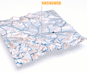 Places with similar names to Kasāvand, Iran ::
Disclaimer :: Information on this page comes without warranty of any kind |
||
|
Where is Kasāvand? Elevation and coordinates ::
Latitude (lat): 33°37'3"N Longitude (lon): 49°36'53"E
Elevation (approx.): 1963m (map arrows pan, magnifying glasses zoom) |
||
|
Visiting Kasāvand? Hotel/Accommodation ::
Book a hotel in Kasāvand Travel Guide ::
Buy a travel guide for Iran rental cars ::
car rental offers GPS waypoint ::
download a GPX waypoint (PoI) of Kasāvand for your GPS receiver
|
||