|
search place name
|
||
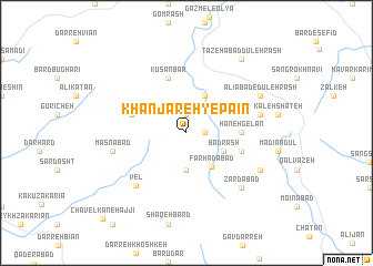
Khanjareh-ye Pāīn (Kordestān, Iran)Khanjareh-ye Pāīn is a town in the Kordestān region of Iran. An overview map of the region around Khanjareh-ye Pāīn is displayed below.
regional and 3d topo map of Khanjareh-ye Pāīn, Iran ::
Khanjareh-ye Pāīn airports ::
The nearest airport is SDG - Sanandaj, located 45.0 km south east of Khanjareh-ye Pāīn.
Other airports nearby include KSH - Bakhtaran Shahid Ashrafi Esfahani (143.7 km south), Nearby towns ::
‘Alī Bolāgh (1.5km east) //
Āqbolāgh (1.9km north) //
Khanjareh-ye Bālā (3.7km south) //
Bazyāvnān (4.0km north) //
Bad Rash (3.5km south east) //
Farhādābād (4.0km south east) //
Hāneh Gelān (4.5km east) //
Kūs ‘Anbar (5.8km north) //
Ḩājjīābād (4.9km east) //
Tāzehābād-e Qāzī (4.9km west) //
Vel (6.7km south west) //
Yūsef Shavān (6.3km east) //
Masnābād (6.3km west) //
Zardābād (7.2km south east) //
‘Alīābād-e Dūleh Rash (7.1km north east) //
Kānī Tāleh (7.1km south east) //
Tāzehābād Dūleh Rash (8.7km north east) //
Chāvelkān-e Ḩājjī (11.0km south west) //
[all distances 'as the bird flies' and approximate]  Places with similar names to Khanjareh-ye Pāīn, Iran ::
// Khanjarī-ye Pā'īn (IR)
Disclaimer :: Information on this page comes without warranty of any kind |
||
|
Where is Khanjareh-ye Pāīn? Elevation and coordinates ::
Latitude (lat): 35°36'0"N Longitude (lon): 46°46'0"E
Elevation (approx.): 2061m (map arrows pan, magnifying glasses zoom) |
||
|
Visiting Khanjareh-ye Pāīn? Hotel/Accommodation ::
Book a hotel in Khanjareh-ye Pāīn Travel Guide ::
Buy a travel guide for Iran rental cars ::
car rental offers GPS waypoint ::
download a GPX waypoint (PoI) of Khanjareh-ye Pāīn for your GPS receiver
|
||