|
search place name
|
||
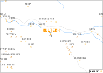
Kūl Terk (Khūzestān, Iran)Kūl Terk is a town in the Khūzestān region of Iran. An overview map of the region around Kūl Terk is displayed below.
regional and 3d topo map of Kūl Terk, Iran ::
Kūl Terk airports ::
The nearest airport is QMJ - Masjed Soleiman Shahid Asyaee, located 92.2 km south of Kūl Terk.
Other airports nearby include AWZ - Ahwaz (171.7 km south), Nearby towns ::
‘Ūdelū (1.9km north) //
Telzīrī (4.8km north west) //
Chūb Āb (4.8km north west) //
Īlard (5.4km north) //
Kover (5.6km north) //
Boneh Band (5.1km south east) //
Sarkol-e Qāyed (5.8km north) //
Galleh Har (6.0km south east) //
Zardoft (6.6km south east) //
Chāl Gach (7.2km south east) //
Labāb (7.2km south west) //
Fīlāb (7.2km north west) //
Mūdū (7.2km south east) //
Gar Kandī (8.3km south east) //
Chāl-e Bard (8.4km south east) //
[all distances 'as the bird flies' and approximate]  Places with similar names to Kūl Terk, Iran ::
// Kaluđerica (BA)
// Koltyrak (RU)
// Gold Rock (US)
// Kaldirec (MK)
// Gol Daraq (IR)
// Goldaraq (IR)
// Golī Daraq (IR)
// Keleh Daraq (IR)
// Kol-e Torkī (IR)
// Qal‘at ar Rakkah (IQ)
Disclaimer :: Information on this page comes without warranty of any kind |
||
|
Where is Kūl Terk? Elevation and coordinates ::
Latitude (lat): 32°50'0"N Longitude (lon): 49°14'0"E
Elevation (approx.): 1025m (map arrows pan, magnifying glasses zoom) |
||
|
Visiting Kūl Terk? Hotel/Accommodation ::
Book a hotel in Kūl Terk Travel Guide ::
Buy a travel guide for Iran rental cars ::
car rental offers GPS waypoint ::
download a GPX waypoint (PoI) of Kūl Terk for your GPS receiver
|
||