|
search place name
|
||
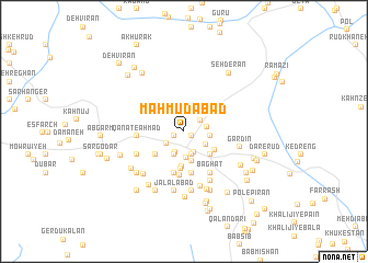
Maḩmūdābād (Kermān, Iran)Maḩmūdābād is a town in the Kermān region of Iran. An overview map of the region around Maḩmūdābād is displayed below.
regional and 3d topo map of Maḩmūdābād, Iran ::
Maḩmūdābād airports ::
The nearest airport is KER - Kerman, located 118.7 km north of Maḩmūdābād.
Nearby towns ::
Qal‘eh-ye Dokhtar (0.9km south east) //
Bāgh-e Ḩoseynī (1.0km south west) //
Bāb Derāz (1.9km north east) //
Bāgh-e ‘Alī Shīr (2.0km south west) //
Deh Kandī (2.2km south) //
Darb-e Mazār (2.3km south) //
Nemch (2.1km east) //
Pīr-e Zārch (2.4km south) //
Qanāt-e Mehdī (2.4km south) //
Sīnābād (2.5km south) //
Ḩenţeh (2.5km south) //
Deh Hendī-ye Pā'īn (2.6km south) //
Kalūk (2.4km south east) //
Deh-e Derāz (2.4km east) //
Bābā Jān (3.1km south) //
Shīr Āghūz (3.3km south east) //
Kahn Sameh (3.6km south) //
Qanāt-e Moḩammad Shāh (3.3km south east) //
Gerdū Chūb (3.5km south west) //
Qanāt Zīr (3.8km south) //
Bīdū'īyeh (4.3km south) //
Moḩammadābād (4.3km south) //
Qanāt-e Sāmān (4.3km south) //
Darreh Now (4.5km south) //
Qanāt-e Aḩmad (4.2km west) //
Bāghāt (4.8km south east) //
Qanāt-e Zangal (4.8km south west) //
Tārīkū'īyeh (5.5km south east) //
Tārīkū (5.5km south east) //
[all distances 'as the bird flies' and approximate] 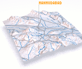 Places with similar names to Maḩmūdābād, Iran ::
// Mǝmmǝdabad (AZ)
// Māmudābād (BD)
// Mahmūdābād (IN)
// Maḩmūdābād (IR)
// Maḩmūdābād (IR)
// Maḩmūdābād (IR)
// Maḩmūdābād (IR)
// Maḩmūdābād (IR)
// Maḩmūdābād (IR)
// Maḩmūdābād (IR)
Disclaimer :: Information on this page comes without warranty of any kind |
||
|
Where is Maḩmūdābād? Elevation and coordinates ::
Latitude (lat): 29°15'16"N Longitude (lon): 57°19'34"E
Elevation (approx.): 2695m (map arrows pan, magnifying glasses zoom) |
||
|
Visiting Maḩmūdābād? Hotel/Accommodation ::
Book a hotel in Maḩmūdābād Travel Guide ::
Buy a travel guide for Iran rental cars ::
car rental offers GPS waypoint ::
download a GPX waypoint (PoI) of Maḩmūdābād for your GPS receiver
|
||