|
search place name
|
||
Malekābād (Iran)Malekābād is a town in Iran. An overview map of the region around Malekābād is displayed below.
regional and 3d topo map of Malekābād, Iran ::

Malekābād airports ::
The nearest airport is THR - Teheran Mehrabad Intl, located 105.0 km north of Malekābād.
Nearby towns ::
Hejdah Dāng (2.0km north) //
‘Alīābād (4.7km north east) //
Qal‘eh-ye Solţān Bājī (4.9km south west) //
Qomrūd (5.2km south east) //
Khedrābād (5.1km north west) //
Seyfābād (5.5km south west) //
Sharīfābād (5.4km south west) //
Qeshlāq-e Alborz (5.9km west) //
Mīrābād (6.1km east) //
Khederābād (7.8km north) //
Samābād (7.7km south east) //
Qeshlāq-e Safarābād (8.5km north west) //
Manşūrīyeh-ye Teymūrīān (8.6km south east) //
Alborz (8.3km south west) //
[all distances 'as the bird flies' and approximate] 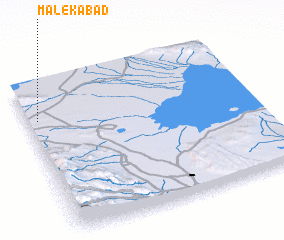 Places with similar names to Malekābād, Iran ::
Disclaimer :: Information on this page comes without warranty of any kind |
||
|
Where is Malekābād? Elevation and coordinates ::
Latitude (lat): 34°46'6"N Longitude (lon): 51°2'57"E
Elevation (approx.): 847m (map arrows pan, magnifying glasses zoom) |
||
|
Visiting Malekābād? Hotel/Accommodation ::
Book a hotel in Malekābād Travel Guide ::
Buy a travel guide for Iran rental cars ::
car rental offers GPS waypoint ::
download a GPX waypoint (PoI) of Malekābād for your GPS receiver
|
||