|
search place name
|
||
Maẕāfeh (Ardabīl, Iran)Maẕāfeh is a town in the Ardabīl region of Iran. An overview map of the region around Maẕāfeh is displayed below.
regional and 3d topo map of Maẕāfeh, Iran ::

Maẕāfeh airports ::
The nearest airport is TBZ - Tabriz Intl, located 143.6 km south west of Maẕāfeh.
Other airports nearby include RAS - Rasht (227.2 km south east), Nearby towns ::
Mer'ātī (1.9km north) //
Morādlū (2.1km north east) //
Qarah Gol (3.3km west) //
Chenār (4.8km west) //
Nīāzqolī (6.2km north) //
Galasan Gūrasan (7.1km south) //
Tak Dām (5.8km north east) //
Sarī (7.1km north west) //
Dāshlī Darreh (7.8km north) //
Qoldor Kohlī (7.8km south west) //
Cher Cher (6.6km west) //
Nūly Bolāghī (7.6km north west) //
Poshteh-ye Qareh Āghāj (7.0km south west) //
Tāzeh Kand-e Arshaq (7.5km south east) //
Ordūkhān Kandī (6.8km east) //
Khānomānlū (7.2km east) //
Mollālū (8.0km north east) //
Chākher Chamanī (9.2km north) //
Dūshānlū (9.2km south) //
Qārī Mazra‘ahsī (10.3km north east) //
Qārī Qeshlāq (10.3km north east) //
Tak Bolāgh (10.3km north east) //
Nūrī Kandī (10.8km south west) //
[all distances 'as the bird flies' and approximate] 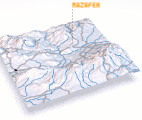 Places with similar names to Maẕāfeh, Iran ::
Disclaimer :: Information on this page comes without warranty of any kind |
||
|
Where is Maẕāfeh? Elevation and coordinates ::
Latitude (lat): 38°42'48"N Longitude (lon): 47°42'17"E
Elevation (approx.): 1350m (map arrows pan, magnifying glasses zoom) |
||
|
Visiting Maẕāfeh? Hotel/Accommodation ::
Book a hotel in Maẕāfeh Travel Guide ::
Buy a travel guide for Iran rental cars ::
car rental offers GPS waypoint ::
download a GPX waypoint (PoI) of Maẕāfeh for your GPS receiver
|
||