|
search place name
|
||
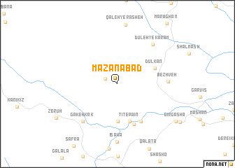
Mazanābād (Ostān-e Āz̄arbāyjān-e Sharqī, Iran)Mazanābād is a town in the Ostān-e Āz̄arbāyjān-e Sharqī region of Iran. An overview map of the region around Mazanābād is displayed below.
regional and 3d topo map of Mazanābād, Iran ::
Mazanābād airports ::
The nearest airport is SDG - Sanandaj, located 170.2 km south east of Mazanābād.
Other airports nearby include KSH - Bakhtaran Shahid Ashrafi Esfahani (246.7 km south east), Nearby towns ::
Bītūsh (1.8km north west) //
Zardekānī-ye Soflá (6.0km south) //
Tīt-e Pā'īn (6.2km south) //
Dūlkān (5.4km north east) //
Dashtī Khānī (6.8km south) //
Tīt-e Bālā (6.8km south east) //
Bezhveh (6.5km east) //
Gākeh Kak (7.5km south west) //
Dūleh-ye Karam (7.8km north east) //
[all distances 'as the bird flies' and approximate]  Places with similar names to Mazanābād, Iran ::
// Masonbiti (TZ)
// Masenābād (IR)
// Masnābād (IR)
// Masnābād (IR)
// Mazanābād (IR)
// Moḩsenābād (IR)
// Moḩsenābād (IR)
// Moḩsenābād (IR)
// Moḩsenābād (IR)
// Moḩsenābād (IR)
Disclaimer :: Information on this page comes without warranty of any kind |
||
|
Where is Mazanābād? Elevation and coordinates ::
Latitude (lat): 36°2'15"N Longitude (lon): 45°23'58"E
Elevation (approx.): 1153m (map arrows pan, magnifying glasses zoom) |
||
|
Visiting Mazanābād? Hotel/Accommodation ::
Book a hotel in Mazanābād Travel Guide ::
Buy a travel guide for Iran rental cars ::
car rental offers GPS waypoint ::
download a GPX waypoint (PoI) of Mazanābād for your GPS receiver
|
||