|
search place name
|
||
Meys̄amābād (Iran)Meys̄amābād is a town in Iran. An overview map of the region around Meys̄amābād is displayed below.
regional and 3d topo map of Meys̄amābād, Iran ::

Meys̄amābād airports ::
The nearest airport is KSH - Bakhtaran Shahid Ashrafi Esfahani, located 182.2 km west of Meys̄amābād.
Nearby towns ::
Fārāb (0.0km north) //
Shāhpūrābād (0.0km north) //
Sīrān (2.4km north west) //
Shāveh (2.4km south east) //
Deh Chāl (2.8km south) //
Dīzaj (3.1km west) //
Chakhmāq Tappeh (3.6km north west) //
Emāmzādeh Deh Chāl (4.0km south) //
Bahārestān (3.6km south east) //
Chīzān (4.2km north) //
Vezvānaq (4.7km north west) //
Ḩoseynābād (5.6km south) //
Karkānak (4.6km east) //
‘Alīābād (6.3km south west) //
Ḩoseynābād (6.2km north east) //
Fūrān (5.8km west) //
Dīzābād (6.4km east) //
Kholūzīn (7.2km north west) //
Jowshīrvān (8.2km south) //
Majīdābād (7.1km north west) //
Gheynarjeh (7.1km north east) //
Deh Now (8.2km south east) //
Qeshlāq-e Qoţbābād (8.3km south east) //
Naşīrābād (9.6km north west) //
[all distances 'as the bird flies' and approximate] 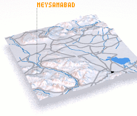 Places with similar names to Meys̄amābād, Iran ::
// Māsimābād (BD)
// Mozamābād (IN)
// Mowsemābād (IR)
// Moazzamābād (PK)
// Muazzamābād (PK)
// Ma‘şūmābād (IR)
// Ma‘şūmābād (IR)
// Ma‘şūmābād (IR)
// Ma‘şūmābād (IR)
// Ma‘şūmābād (IR)
Disclaimer :: Information on this page comes without warranty of any kind |
||
|
Where is Meys̄amābād? Elevation and coordinates ::
Latitude (lat): 34°29'0"N Longitude (lon): 49°8'0"E
Elevation (approx.): 1660m (map arrows pan, magnifying glasses zoom) |
||
|
Visiting Meys̄amābād? Hotel/Accommodation ::
Book a hotel in Meys̄amābād Travel Guide ::
Buy a travel guide for Iran rental cars ::
car rental offers GPS waypoint ::
download a GPX waypoint (PoI) of Meys̄amābād for your GPS receiver
|
||