|
search place name
|
||
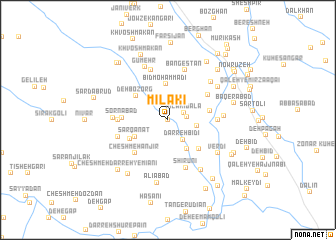
Mīlakī (Fārs, Iran)Mīlakī is a town in the Fārs region of Iran. An overview map of the region around Mīlakī is displayed below.
regional and 3d topo map of Mīlakī, Iran ::
Mīlakī airports ::
The nearest airport is SYZ - Shiraz Shahid Dastghaib Intl, located 88.2 km south east of Mīlakī.
Other airports nearby include BUZ - Bushehr (172.5 km south west), Nearby towns ::
Do Rūdeh (0.0km north) //
Mīlākī Bālā (1.8km north east) //
Namāzgah (1.8km east) //
Darreh Bīdī (2.6km south east) //
Tall Kord (2.9km east) //
Cheshmeh Baklū (3.7km south east) //
Bīd Moḩammadī (4.0km north) //
Sar Qanāt (3.7km south west) //
Deh Bozorg (4.1km north west) //
Darreh-ye Ḩeydarī (4.4km south east) //
Shāh Moḩammadī (4.3km south west) //
Qal‘eh-ye Khalīlī (4.2km east) //
Sornābād (4.4km west) //
Cheshmeh Anjīr (4.9km south west) //
Namāzgāh (4.7km north east) //
Cheshmeh Sefīd (4.8km west) //
Bazmak-e Pā'īn (4.8km west) //
Bīzmak (4.8km west) //
Chenār (4.8km east) //
Ḥājjīābād (4.8km east) //
Shīrūnī (5.6km south) //
Qanāt (5.2km west) //
Gelūmehr (5.8km north) //
Bangestān (5.8km north) //
Bazmak-e Bālā (5.3km west) //
Tol Gerd (5.5km east) //
Deh Ḩarakat (5.9km north east) //
Gūmehr (6.3km north) //
Verdī (6.1km south east) //
[all distances 'as the bird flies' and approximate]  Places with similar names to Mīlakī, Iran ::
Disclaimer :: Information on this page comes without warranty of any kind |
||
|
Where is Mīlakī? Elevation and coordinates ::
Latitude (lat): 30°8'0"N Longitude (lon): 51°59'0"E
Elevation (approx.): 1902m (map arrows pan, magnifying glasses zoom) |
||
|
Visiting Mīlakī? Hotel/Accommodation ::
Book a hotel in Mīlakī Travel Guide ::
Buy a travel guide for Iran rental cars ::
car rental offers GPS waypoint ::
download a GPX waypoint (PoI) of Mīlakī for your GPS receiver
|
||