|
search place name
|
||
Mīsh Rangīn (Ostān-e Kermānshāh, Iran)Mīsh Rangīn is a town in the Ostān-e Kermānshāh region of Iran. An overview map of the region around Mīsh Rangīn is displayed below.
regional and 3d topo map of Mīsh Rangīn, Iran ::

Mīsh Rangīn airports ::
The nearest airport is SDG - Sanandaj, located 123.7 km north east of Mīsh Rangīn.
Other airports nearby include KSH - Bakhtaran Shahid Ashrafi Esfahani (129.8 km east), Nearby towns ::
Sarā'ī (1.9km south) //
Gardanū (1.5km west) //
Na‘lband (2.4km south east) //
Qāderī (2.4km south east) //
‘Alī Yārkī (2.4km south east) //
Gāv Kharī-ye Pā'īn (2.5km north west) //
Tappeh Kabūd-e Bālā (4.0km south) //
Tappeh Kabūd-e Pā'īn (4.0km south) //
Tūvashkeh (3.8km north east) //
‘Alī Āqā'ī-ye Pā'īn (5.8km north) //
Sar Qal‘eh (5.1km north west) //
Kal-e Sefīd (5.9km north east) //
Morād Khānī (5.9km south east) //
Maleh Dazgeh (6.9km south) //
Dār Zanganeh-ye Pā'īn (7.2km north) //
‘Alī Āqā'ī-ye Bālā (7.4km north) //
Dārvand-e Zard (6.4km west) //
Ā'īnehvand-e Morādkhānī (7.2km south east) //
Dārtūt (7.2km south east) //
Dār Reshteh (7.7km south east) //
Pol-e Tūt (7.9km south east) //
Qalameh (9.0km south) //
Ḩoseynābād (9.0km north) //
Ravīleh (9.3km north west) //
Chenāreh-ye Majīd (9.6km south east) //
Chenāreh-ye ‘Alī Madad (9.9km south east) //
[all distances 'as the bird flies' and approximate] 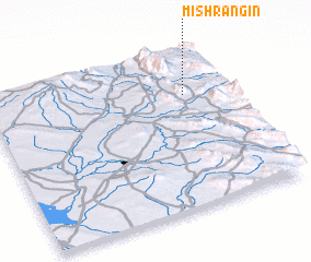 Places with similar names to Mīsh Rangīn, Iran :: Disclaimer :: Information on this page comes without warranty of any kind |
||
|
Where is Mīsh Rangīn? Elevation and coordinates ::
Latitude (lat): 34°43'0"N Longitude (lon): 45°49'0"E
Elevation (approx.): 571m (map arrows pan, magnifying glasses zoom) |
||
|
Visiting Mīsh Rangīn? Hotel/Accommodation ::
Book a hotel in Mīsh Rangīn Travel Guide ::
Buy a travel guide for Iran rental cars ::
car rental offers GPS waypoint ::
download a GPX waypoint (PoI) of Mīsh Rangīn for your GPS receiver
|
||