|
search place name
|
||
Naşrovān (Fārs, Iran)Naşrovān is a town in the Fārs region of Iran. An overview map of the region around Naşrovān is displayed below.
regional and 3d topo map of Naşrovān, Iran ::

Naşrovān airports ::
The nearest airport is SYZ - Shiraz Shahid Dastghaib Intl, located 200.7 km north west of Naşrovān.
Other airports nearby include BND - Bandar Abbass Intl (252.4 km south east), Nearby towns ::
Bīzdān (2.7km south east) //
Ghīās̄ī (4.1km north) //
Sākhtemān-e Jamāl Ḩeydarlū (4.2km north) //
Dehkestān (4.4km north) //
Khorūslū (4.4km north east) //
Herbedān (4.5km east) //
Jowzjān (4.6km east) //
Barāb (6.0km north) //
Eslāmābād (6.3km north) //
Shamsābād (6.6km north) //
Karīmlū (6.3km east) //
Bahāderān (6.6km west) //
Bīādeh (6.6km east) //
Dalangūneh (6.7km west) //
Tīzāb (7.5km north) //
Sākhtemān-e Aḩmadlū (7.8km north) //
Gar Ashkān (7.2km east) //
Qal‘eh Now (7.6km east) //
Bakhtājerd (8.6km north east) //
Jamsī (9.1km north east) //
Tall-e Oskū (10.9km north west) //
[all distances 'as the bird flies' and approximate] 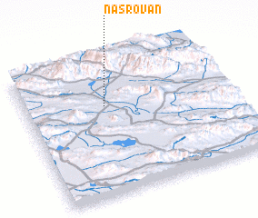 Places with similar names to Naşrovān, Iran :: Disclaimer :: Information on this page comes without warranty of any kind |
||
|
Where is Naşrovān? Elevation and coordinates ::
Latitude (lat): 28°39'48"N Longitude (lon): 54°23'41"E
Elevation (approx.): 1065m (map arrows pan, magnifying glasses zoom) |
||
|
Visiting Naşrovān? Hotel/Accommodation ::
Book a hotel in Naşrovān Travel Guide ::
Buy a travel guide for Iran rental cars ::
car rental offers GPS waypoint ::
download a GPX waypoint (PoI) of Naşrovān for your GPS receiver
|
||