|
search place name
|
||
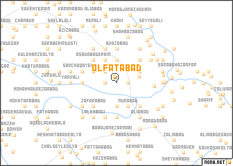
Olfatābād (Lorestān, Iran)Olfatābād is a town in the Lorestān region of Iran. An overview map of the region around Olfatābād is displayed below.
regional and 3d topo map of Olfatābād, Iran ::
Olfatābād airports ::
The nearest airport is KSH - Bakhtaran Shahid Ashrafi Esfahani, located 77.9 km west of Olfatābād.
Other airports nearby include SDG - Sanandaj (153.6 km north west), Nearby towns ::
Aşgharābād (1.5km east) //
Jamālābād (1.5km east) //
Choqā Salmān-e Bālā (1.5km west) //
Gerdakāneh (2.4km north west) //
Noşratābād (3.7km north) //
Karīmābād (3.7km south) //
Haft Cheshmeh-ye Zangīvand (3.1km east) //
Deh Now (4.0km north) //
Ḩasanābād-e Sanjābī (3.6km north east) //
Nūrābād (4.0km south) //
Moḩammadābād (4.0km south) //
Manşūrābād (4.0km south) //
Darreh Dīv (3.6km north west) //
Ḩasanābād (4.8km north east) //
Asadābād-e Pā'īn (4.8km north west) //
Asadābād Sanjābī-ye Bālā (4.8km north west) //
Khalīfehābād (4.8km south east) //
Z̧afarābād (4.8km south west) //
Shokrābād (4.8km south west) //
Raḩmatābād (5.6km north) //
‘Avaẕābād (5.6km north) //
Pāshāābād (4.6km west) //
Kāz̧emābād (5.6km south) //
Karamābād (5.6km south) //
Bābā Moḩammad (5.8km north) //
Sar Choqā-ye Bālā (5.0km west) //
Ḩājjīābād (5.8km south) //
Ḩasanābād (5.8km south) //
‘Azīzābād-e Soflá (5.0km east) //
[all distances 'as the bird flies' and approximate] 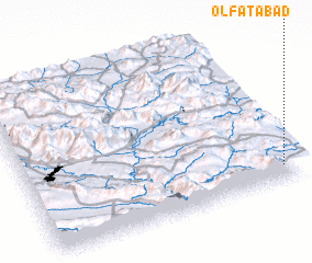 Places with similar names to Olfatābād, Iran :: Disclaimer :: Information on this page comes without warranty of any kind |
||
|
Where is Olfatābād? Elevation and coordinates ::
Latitude (lat): 34°6'0"N Longitude (lon): 47°57'0"E
Elevation (approx.): 1877m (map arrows pan, magnifying glasses zoom) |
||
|
Visiting Olfatābād? Hotel/Accommodation ::
Book a hotel in Olfatābād Travel Guide ::
Buy a travel guide for Iran rental cars ::
car rental offers GPS waypoint ::
download a GPX waypoint (PoI) of Olfatābād for your GPS receiver
|
||