|
search place name
|
||
Pārāh Pūneh (Lorestān, Iran)Pārāh Pūneh is a town in the Lorestān region of Iran. An overview map of the region around Pārāh Pūneh is displayed below.
regional and 3d topo map of Pārāh Pūneh, Iran ::

Pārāh Pūneh airports ::
The nearest airport is KSH - Bakhtaran Shahid Ashrafi Esfahani, located 158.4 km north west of Pārāh Pūneh.
Other airports nearby include QMJ - Masjed Soleiman Shahid Asyaee (193.0 km south), SDG - Sanandaj (232.1 km north west), Nearby towns ::
Khalīl Beygī-ye Pārāpūneh (0.0km north) //
Choghālbal-e ‘Alībakhsh (1.0km north west) //
Merrīkhī (1.7km south) //
Sharafbag (1.9km north) //
Kolah Jū (1.9km south) //
Ḩamzehābād (1.5km west) //
Khomsīāneh-ye Mūsáābād (2.4km south east) //
Bāqlākūb-e ‘Olyā (2.4km south west) //
Kāsīān-e Ayāzābād (3.4km south) //
Shāhzādeh Aḩmad (3.7km south) //
Khomsīāneh-ye ‘Olyā (3.7km south) //
Sarāb-e Ganj ‘Ālī (3.6km north) //
Bardbol (4.0km north east) //
Zārrīn Jūb (4.0km north west) //
Darreh-ye Bīzhan-e Vosţá (3.6km north west) //
Khomsīāneh-ye Rīsh Sefīd (4.0km south west) //
Bāqlākūb-e Soflá (4.3km south) //
Qanāt-e Kāsīān (3.7km south west) //
Dehnow-e Sūkī (4.4km south) //
Sarāb Sabz (4.3km north west) //
Cham Seyyed (4.8km north east) //
Khomsīāneh-ye Soflá (4.9km south west) //
Darreh-ye Ḩoseyn (4.8km north east) //
Sarāb-e ‘Asgar (4.8km north west) //
Har Kūh (4.8km south west) //
Pūneh (4.5km west) //
Sūkī-ye Soflá (5.6km south) //
Qal‘eh-ye Kāsīān (4.9km south west) //
Eslāmābād (5.0km east) //
[all distances 'as the bird flies' and approximate] 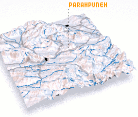 Places with similar names to Pārāh Pūneh, Iran ::
Disclaimer :: Information on this page comes without warranty of any kind |
||
|
Where is Pārāh Pūneh? Elevation and coordinates ::
Latitude (lat): 33°40'0"N Longitude (lon): 48°40'0"E
Elevation (approx.): 1784m (map arrows pan, magnifying glasses zoom) |
||
|
Visiting Pārāh Pūneh? Hotel/Accommodation ::
Book a hotel in Pārāh Pūneh Travel Guide ::
Buy a travel guide for Iran rental cars ::
car rental offers GPS waypoint ::
download a GPX waypoint (PoI) of Pārāh Pūneh for your GPS receiver
|
||