|
search place name
|
||
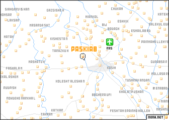
Pāskīāb (Gīlān, Iran)Pāskīāb is a town in the Gīlān region of Iran. An overview map of the region around Pāskīāb is displayed below.
regional and 3d topo map of Pāskīāb, Iran ::
Pāskīāb airports ::
The nearest airport is RAS - Rasht, located 6.0 km north east of Pāskīāb.
Other airports nearby include RZR - Ramsar (108.5 km south east), THR - Teheran Mehrabad Intl (237.4 km south east), Nearby towns ::
Tāzehābād (1.0km north) //
‘Eynak (1.6km south) //
Sīāh Esţalakh (2.0km north) //
Sīāh Esţalkh (2.0km north) //
Nokhowd Char (2.2km south west) //
Būsār (2.2km east) //
Fakhab (2.6km north east) //
Şaf-e Sar (3.1km south) //
Rāsteh Kenār (2.7km north east) //
Bālā Kūyakh (2.8km east) //
Kamākol (3.4km north) //
Rasht (3.0km south east) //
Pastak (3.3km north east) //
Aḩmad Gūrāb (3.4km south west) //
Ālmān (4.0km north east) //
Gālesh Gācheh (4.8km north) //
Soleymān Dārāb (4.5km south east) //
Chehel Mardān (4.3km north west) //
Pīleh Dārbon (4.9km north) //
Pasvīsheh (4.0km west) //
Paspīsheh (4.0km west) //
Ţarāz Kūh (4.2km west) //
Vīshkā Varzal (5.4km south) //
Maskūdeh (5.3km north) //
Shams-e Bījār (4.6km north east) //
Āteshgāh (4.6km south west) //
Khān Afjeh (5.5km north) //
Rokan Sarā (5.4km north east) //
Sūkhteh Lūleh (6.0km north) //
[all distances 'as the bird flies' and approximate]  Places with similar names to Pāskīāb, Iran ::
// Pasagba (CD)
Disclaimer :: Information on this page comes without warranty of any kind |
||
|
Where is Pāskīāb? Elevation and coordinates ::
Latitude (lat): 37°17'24"N Longitude (lon): 49°33'18"E
Elevation (approx.): -9m (map arrows pan, magnifying glasses zoom) |
||
|
Visiting Pāskīāb? Hotel/Accommodation ::
Book a hotel in Pāskīāb Travel Guide ::
Buy a travel guide for Iran rental cars ::
car rental offers GPS waypoint ::
download a GPX waypoint (PoI) of Pāskīāb for your GPS receiver
|
||