|
search place name
|
||
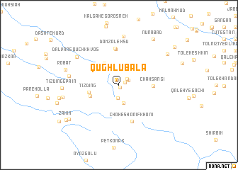
Qūghlū Bālā (Fārs, Iran)Qūghlū Bālā is a town in the Fārs region of Iran. An overview map of the region around Qūghlū Bālā is displayed below.
regional and 3d topo map of Qūghlū Bālā, Iran ::
Qūghlū Bālā airports ::
The nearest airport is BUZ - Bushehr, located 130.8 km south west of Qūghlū Bālā.
Other airports nearby include SYZ - Shiraz Shahid Dastghaib Intl (131.8 km south east), Nearby towns ::
Darreh Bīdī (0.4km south) //
Morgh-e Kūchek (0.9km north east) //
Qūghlū Pā'īn (1.4km north east) //
Gar-e Sefīd (1.5km north east) //
Mashīl-e Bondār (2.0km south) //
Chū‘alū-ye Bālā (2.9km south) //
Gūr Sefīd (3.3km north east) //
Dalvār-e Gūdarzkey Khān (4.0km north west) //
Tīzdīng (4.2km west) //
Tīzdīng-e Bālā (4.3km south west) //
Chāh Sangī (4.7km east) //
Damzalehsū (5.7km north) //
Damzalehsū (5.8km north) //
Chāh-e Sharīf Khānī (6.0km south) //
Qal‘eh-ye Amīr Ḩamzeh (7.7km north) //
Dalvār-e Qūch Khvos (7.2km north west) //
‘Alīvarz (7.0km west) //
Robāţ (7.7km west) //
Kūh-e Zarmozhgān (8.2km north east) //
Nūrābād (8.6km north east) //
Qal‘eh-ye Fatḩollāh (7.9km west) //
Beshārgān (8.7km south west) //
Zaḩīm (9.1km south west) //
Mādar Dokhtar (9.6km north east) //
[all distances 'as the bird flies' and approximate] 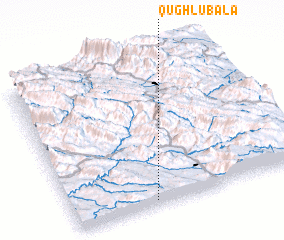 Places with similar names to Qūghlū Bālā, Iran :: Disclaimer :: Information on this page comes without warranty of any kind |
||
|
Where is Qūghlū Bālā? Elevation and coordinates ::
Latitude (lat): 30°2'6"N Longitude (lon): 51°21'4"E
Elevation (approx.): 1241m (map arrows pan, magnifying glasses zoom) |
||
|
Visiting Qūghlū Bālā? Hotel/Accommodation ::
Book a hotel in Qūghlū Bālā Travel Guide ::
Buy a travel guide for Iran rental cars ::
car rental offers GPS waypoint ::
download a GPX waypoint (PoI) of Qūghlū Bālā for your GPS receiver
|
||