|
search place name
|
||
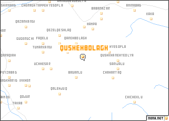
Qūsheh Bolāgh (Ostān-e Āz̄arbāyjān-e Sharqī, Iran)Qūsheh Bolāgh is a town in the Ostān-e Āz̄arbāyjān-e Sharqī region of Iran. An overview map of the region around Qūsheh Bolāgh is displayed below.
regional and 3d topo map of Qūsheh Bolāgh, Iran ::
Qūsheh Bolāgh airports ::
The nearest airport is SDG - Sanandaj, located 140.8 km south of Qūsheh Bolāgh.
Other airports nearby include TBZ - Tabriz Intl (202.4 km north west), Nearby towns ::
Badarlū (4.0km south) //
Āqbolāgh-e Hamadān (3.5km north west) //
Qareh Bolāgh (4.0km north) //
Qūshkhāneh-ye Soflá (4.8km north east) //
Qareh Nāz (5.8km north west) //
Hampā (7.1km north) //
Chahār Ţāq (6.3km south east) //
Qūshkhāneh-ye ‘Olyā (6.0km east) //
Gonbad (7.4km north) //
Sārījālū (6.2km east) //
Asad Kandī (6.2km west) //
Berenjeh (7.1km north west) //
Qezel Qeshlāq (7.1km north west) //
Qal‘eh Jūq (8.7km south west) //
[all distances 'as the bird flies' and approximate] 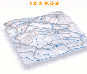 Places with similar names to Qūsheh Bolāgh, Iran ::
// Qūch Bolāghī (IR)
// Qūsh Bolāgh (IR)
// Qūsheh Bolāgh (IR)
// Qūsheh Bolāgh (IR)
// Qūsheh Bolāgh (IR)
Disclaimer :: Information on this page comes without warranty of any kind |
||
|
Where is Qūsheh Bolāgh? Elevation and coordinates ::
Latitude (lat): 36°30'0"N Longitude (lon): 47°15'0"E
Elevation (approx.): 2394m (map arrows pan, magnifying glasses zoom) |
||
|
Visiting Qūsheh Bolāgh? Hotel/Accommodation ::
Book a hotel in Qūsheh Bolāgh Travel Guide ::
Buy a travel guide for Iran rental cars ::
car rental offers GPS waypoint ::
download a GPX waypoint (PoI) of Qūsheh Bolāgh for your GPS receiver
|
||