|
search place name
|
||
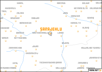
Sarājehlū (Ostān-e Āz̄arbāyjān-e Sharqī, Iran)Sarājehlū is a town in the Ostān-e Āz̄arbāyjān-e Sharqī region of Iran. An overview map of the region around Sarājehlū is displayed below.
regional and 3d topo map of Sarājehlū, Iran ::
Sarājehlū airports ::
The nearest airport is TBZ - Tabriz Intl, located 83.6 km south west of Sarājehlū.
Nearby towns ::
Lāmān (2.9km east) //
Sheykh Aḩmadlū (2.9km west) //
Ārpālīq (3.4km north west) //
Abkhard (4.7km south east) //
Bīrāneh (4.7km north west) //
Anjerd (5.7km south east) //
Jājān (6.5km south west) //
Nabī Jān (7.1km north west) //
Kūr (6.9km north east) //
Jond (8.6km north east) //
Khvoʼīn Dīzaj (9.2km south west) //
[all distances 'as the bird flies' and approximate]  Places with similar names to Sarājehlū, Iran ::
Disclaimer :: Information on this page comes without warranty of any kind |
||
|
Where is Sarājehlū? Elevation and coordinates ::
Latitude (lat): 38°42'0"N Longitude (lon): 46°52'0"E
Elevation (approx.): 2257m (map arrows pan, magnifying glasses zoom) |
||
|
Visiting Sarājehlū? Hotel/Accommodation ::
Book a hotel in Sarājehlū Travel Guide ::
Buy a travel guide for Iran rental cars ::
car rental offers GPS waypoint ::
download a GPX waypoint (PoI) of Sarājehlū for your GPS receiver
|
||