|
search place name
|
||
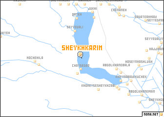
Sheykh Karīm (Khūzestān, Iran)Sheykh Karīm is a town in the Khūzestān region of Iran. An overview map of the region around Sheykh Karīm is displayed below.
regional and 3d topo map of Sheykh Karīm, Iran ::
Sheykh Karīm airports ::
The nearest airport is AWZ - Ahwaz, located 78.9 km south east of Sheykh Karīm.
Other airports nearby include QMJ - Masjed Soleiman Shahid Asyaee (96.1 km east), BSR - Basrah Intl (160.8 km south), ABD - Abadan (170.1 km south), MRX - Bandar Mahshahr Mahshahr (172.0 km south east), Nearby towns ::
Chāy Seder (2.5km south) //
Sheykh Fāleḩ (3.5km south) //
Seyyed ‘Alī (6.4km north) //
Khomeys-e Sheykh Ẕabī‘ (7.8km south east) //
‘Abdol Khān-e Bālā (7.1km east) //
Kheyrābād (8.2km south east) //
Ḩājjī Şāleḩ (9.2km south east) //
Sheykh Fāres (9.5km south east) //
Sheykh Zeybak (10.1km south east) //
[all distances 'as the bird flies' and approximate] 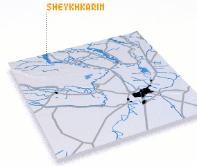 Places with similar names to Sheykh Karīm, Iran ::
// Shakhkerem (AZ)
// Shaykh Karīm (IQ)
Disclaimer :: Information on this page comes without warranty of any kind |
||
|
Where is Sheykh Karīm? Elevation and coordinates ::
Latitude (lat): 31°54'18"N Longitude (lon): 48°15'39"E
Elevation (approx.): 43m (map arrows pan, magnifying glasses zoom) |
||
|
Visiting Sheykh Karīm? Hotel/Accommodation ::
Book a hotel in Sheykh Karīm Travel Guide ::
Buy a travel guide for Iran rental cars ::
car rental offers GPS waypoint ::
download a GPX waypoint (PoI) of Sheykh Karīm for your GPS receiver
|
||