|
search place name
|
||
Sīāh Kamar (Ostān-e Kermānshāh, Iran)Sīāh Kamar is a town in the Ostān-e Kermānshāh region of Iran. An overview map of the region around Sīāh Kamar is displayed below.
regional and 3d topo map of Sīāh Kamar, Iran ::

Sīāh Kamar airports ::
The nearest airport is KSH - Bakhtaran Shahid Ashrafi Esfahani, located 15.3 km east of Sīāh Kamar.
Other airports nearby include SDG - Sanandaj (99.3 km north), Nearby towns ::
Darreh Darīsh (3.0km south east) //
Chāvoshān (3.8km south) //
Bābā Jān (4.3km north west) //
Bābā Jān-e Pālīzī (4.4km north west) //
Dūstvand (4.0km north east) //
Darkeh-ye Gholām ‘Alī (4.4km south west) //
‘Omar Mel (4.5km north east) //
Yārvā (5.0km south east) //
Sharāb Khoshkeh-ye Bālā (5.3km north east) //
Sarāb Khoshkeh-ye ‘Olyā (5.6km north east) //
Darkeh-ye Mofīdī (5.1km south west) //
Darkeh-ye Moḩammad ‘Alī (5.4km south west) //
Darkeh-ye Cheshmeh Sefīd (5.4km south west) //
Sarāb-e Khoshkeh-ye Soflá (6.0km north east) //
Ḩājjī ‘Azīz-e Cheshmeh Sefīd (6.4km south) //
Yalveh-ye ‘Olyā (5.6km west) //
Darkeh-ye Ḩasankhānī (5.7km west) //
Mehdīābād (6.4km north west) //
Naz̧arābād-e ‘Olyā (6.8km north) //
Darkeh (6.8km south west) //
Tavakkolābād (6.6km south east) //
Qal‘eh Kohneh (6.2km east) //
Pīr Ḩayātī (7.7km north) //
Toveh-e Laţīf (7.8km south) //
Cheshmeh Sefīd (8.2km south) //
Yalveh-ye Soflá (6.9km west) //
Kahrīz (7.3km north east) //
Fereydūn (7.1km west) //
Ḩoseynābād (8.5km north) //
[all distances 'as the bird flies' and approximate] 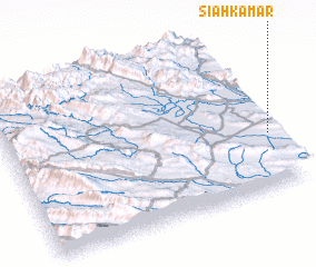 Places with similar names to Sīāh Kamar, Iran ::
// Shkëmber (AL)
// Chekmari (RU)
// Chekmari (RU)
// Chekmari (RU)
// Shaykh Hōmar (IQ)
// Chekhmūr (IR)
// Chak Umra (IN)
// Tiakmar (SN)
// Sīāh Kamar (IR)
// Sīāh Kamar (IR)
Disclaimer :: Information on this page comes without warranty of any kind |
||
|
Where is Sīāh Kamar? Elevation and coordinates ::
Latitude (lat): 34°21'3"N Longitude (lon): 46°59'30"E
Elevation (approx.): 1376m (map arrows pan, magnifying glasses zoom) |
||
|
Visiting Sīāh Kamar? Hotel/Accommodation ::
Book a hotel in Sīāh Kamar Travel Guide ::
Buy a travel guide for Iran rental cars ::
car rental offers GPS waypoint ::
download a GPX waypoint (PoI) of Sīāh Kamar for your GPS receiver
|
||