|
search place name
|
||
Ţālebābād (Iran)Ţālebābād is a town in Iran. An overview map of the region around Ţālebābād is displayed below.
regional and 3d topo map of Ţālebābād, Iran ::
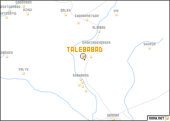
Nearby towns ::
Rāh Band (1.4km north east) //
Emāmzādeh Qāsem (3.6km north east) //
Shāh Band (4.3km south) //
Poshteh (4.9km south) //
Eslāmābād (5.5km south) //
Darjazīn (5.8km south) //
Chehel Tan (6.7km south) //
‘Alīābād (6.9km north) //
Shahmīrzād (8.4km north) //
[all distances 'as the bird flies' and approximate] 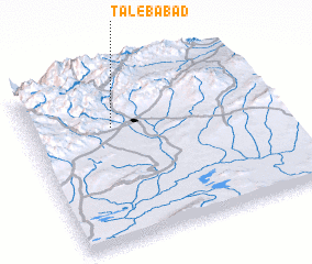 Places with similar names to Ţālebābād, Iran ::
Disclaimer :: Information on this page comes without warranty of any kind |
||
|
Where is Ţālebābād? Elevation and coordinates ::
Latitude (lat): 35°41'33"N Longitude (lon): 53°20'19"E
Elevation (approx.): 1567m (map arrows pan, magnifying glasses zoom) |
||
|
Visiting Ţālebābād? Hotel/Accommodation ::
Book a hotel in Ţālebābād Travel Guide ::
Buy a travel guide for Iran rental cars ::
car rental offers GPS waypoint ::
download a GPX waypoint (PoI) of Ţālebābād for your GPS receiver
|
||