|
search place name
|
||
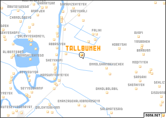
Tall Būmeh (Khūzestān, Iran)Tall Būmeh is a town in the Khūzestān region of Iran. An overview map of the region around Tall Būmeh is displayed below.
regional and 3d topo map of Tall Būmeh, Iran ::
Tall Būmeh airports ::
The nearest airport is AWZ - Ahwaz, located 26.1 km south west of Tall Būmeh.
Other airports nearby include QMJ - Masjed Soleiman Shahid Asyaee (62.0 km north east), MRX - Bandar Mahshahr Mahshahr (109.8 km south), ABD - Abadan (144.4 km south west), BSR - Basrah Intl (162.2 km south west), Nearby towns ::
Mo'asseseh-ye Ḩājjī Ḩamū (3.7km north west) //
Mo'asseseh-ye Ḩājjī Khān Dūstī (3.5km west) //
Zoveyr-e Kharāmzeh (4.1km north) //
Sheykh Mūsá (5.0km north east) //
Omm ol Gharīb-e Kuchek (4.9km south east) //
Ḩelleh va Delleh (5.2km west) //
Zoveyr-e Charī (6.0km north) //
‘Abbāsīyeh (5.6km north west) //
Falīḩī (6.2km north east) //
Manşūrīyeh-ye Do (5.6km west) //
Sheykh ‘Ufi (5.7km west) //
Manşūrīyeh-ye Seh (5.9km south west) //
‘Ammāshīyeh-ye Yek (6.1km south west) //
Omm ol Gharīb-e Bozorg (6.2km south east) //
Veys (6.8km south west) //
Būḩer (7.1km north west) //
Manşūrīyeh-ye Yek (7.1km south west) //
Sheykh Kāz̧em (7.1km north west) //
Mollā S̄ānī (7.6km north west) //
Sharī Marī (7.7km north west) //
Moveyleḩeh (7.7km south west) //
Malīḩeh (7.8km south west) //
Ḩobeyshī (7.4km east) //
Şoley‘eh (8.7km north) //
Şoley‘eh (8.7km north) //
Mazra‘eh-ye Sheykh Karīm (8.8km north west) //
Amīleh (8.7km south west) //
Omm ol Balābīl (8.9km south east) //
Vahābī (9.5km north west) //
[all distances 'as the bird flies' and approximate]  Places with similar names to Tall Būmeh, Iran ::
// Talaboum (CF)
// Tullabembi (NG)
// Tŭlbaemi (KR)
// Dala Bombo (AO)
// Dalabumba (AO)
// Dalawbama (MM)
Disclaimer :: Information on this page comes without warranty of any kind |
||
|
Where is Tall Būmeh? Elevation and coordinates ::
Latitude (lat): 31°31'37"N Longitude (lon): 48°55'31"E
Elevation (approx.): 24m (map arrows pan, magnifying glasses zoom) |
||
|
Visiting Tall Būmeh? Hotel/Accommodation ::
Book a hotel in Tall Būmeh Travel Guide ::
Buy a travel guide for Iran rental cars ::
car rental offers GPS waypoint ::
download a GPX waypoint (PoI) of Tall Būmeh for your GPS receiver
|
||