|
search place name
|
||
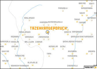
Tāzeh Kand-e Porūch (Ostān-e Āz̄arbāyjān-e Sharqī, Iran)Tāzeh Kand-e Porūch is a town in the Ostān-e Āz̄arbāyjān-e Sharqī region of Iran. An overview map of the region around Tāzeh Kand-e Porūch is displayed below.
regional and 3d topo map of Tāzeh Kand-e Porūch, Iran ::
Tāzeh Kand-e Porūch airports ::
The nearest airport is TBZ - Tabriz Intl, located 145.1 km west of Tāzeh Kand-e Porūch.
Other airports nearby include RAS - Rasht (166.0 km east), Nearby towns ::
Ḩājjī Hemmatlū (1.9km south) //
Zaren Kesh (2.4km south west) //
Afẕal (2.4km north east) //
Qarah Ḩājjīlū-ye ‘Olyā (2.9km west) //
Qarah Ḩājjīlū-ye Soflá (2.9km west) //
Benāravān (3.7km north) //
Khānqāh (4.0km north) //
Āvīn-e Masjedlū (4.5km north east) //
Chorūr (4.7km south west) //
‘Alī Beyglū (4.8km north east) //
Hendelān (5.8km south) //
Gomeyn (5.9km east) //
Gangadīk (6.2km west) //
Sefīd Khānī (6.2km east) //
Dīzaj (7.1km south east) //
Bāl Lūjah (6.9km south west) //
Tark (8.3km south) //
Naslāndeh (8.1km north west) //
[all distances 'as the bird flies' and approximate] 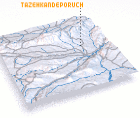 Places with similar names to Tāzeh Kand-e Porūch, Iran :: Disclaimer :: Information on this page comes without warranty of any kind |
||
|
Where is Tāzeh Kand-e Porūch? Elevation and coordinates ::
Latitude (lat): 37°41'0"N Longitude (lon): 47°47'0"E
Elevation (approx.): 1748m (map arrows pan, magnifying glasses zoom) |
||
|
Visiting Tāzeh Kand-e Porūch? Hotel/Accommodation ::
Book a hotel in Tāzeh Kand-e Porūch Travel Guide ::
Buy a travel guide for Iran rental cars ::
car rental offers GPS waypoint ::
download a GPX waypoint (PoI) of Tāzeh Kand-e Porūch for your GPS receiver
|
||