|
search place name
|
||
Tejdānū (Kermān, Iran)Tejdānū is a town in the Kermān region of Iran. An overview map of the region around Tejdānū is displayed below.
regional and 3d topo map of Tejdānū, Iran ::

Tejdānū airports ::
The nearest airport is BND - Bandar Abbass Intl, located 112.4 km west of Tejdānū.
Other airports nearby include KHS - Khasab (177.9 km south west), RKT - Ras Al Khaimah Intl (244.1 km south west), SHJ - Sharjah Intl (295.7 km south west), Nearby towns ::
Āb Damīl (0.9km north east) //
Rowẕeh-ye Ḩaram (2.0km north) //
Rowẕeh-ye Eram (2.6km north) //
Khosrowābād (5.4km north) //
Dūk (5.6km north) //
Bon-e ‘Ūr (5.7km east) //
Bongajg (6.2km south east) //
Cheshmeh (7.4km north) //
Chāh Shāhī (7.7km south) //
Nāz Dasht (7.3km west) //
Tarūn (9.0km north east) //
[all distances 'as the bird flies' and approximate] 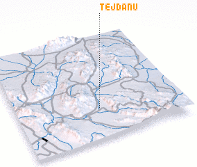 Places with similar names to Tejdānū, Iran ::
// Djedina (BA)
// Dodgetown (US)
// Tāj ed Dīn (IR)
// Tāj ed Dīn (IR)
// Tāj ed Dīn (IR)
// Tāj od Dīn (IR)
// Tāj od Dīn (IR)
// Tajuddin (PK)
// Djidièni (ML)
// Daijiadian (CN)
Disclaimer :: Information on this page comes without warranty of any kind |
||
|
Where is Tejdānū? Elevation and coordinates ::
Latitude (lat): 27°18'13"N Longitude (lon): 57°30'31"E
Elevation (approx.): 282m (map arrows pan, magnifying glasses zoom) |
||
|
Visiting Tejdānū? Hotel/Accommodation ::
Book a hotel in Tejdānū Travel Guide ::
Buy a travel guide for Iran rental cars ::
car rental offers GPS waypoint ::
download a GPX waypoint (PoI) of Tejdānū for your GPS receiver
|
||