|
search place name
|
||
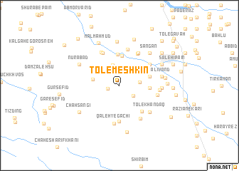
Tol-e Meshkīn (Fārs, Iran)Tol-e Meshkīn is a town in the Fārs region of Iran. An overview map of the region around Tol-e Meshkīn is displayed below.
regional and 3d topo map of Tol-e Meshkīn, Iran ::
Tol-e Meshkīn airports ::
The nearest airport is SYZ - Shiraz Shahid Dastghaib Intl, located 124.3 km south east of Tol-e Meshkīn.
Other airports nearby include BUZ - Bushehr (138.6 km south west), Nearby towns ::
Ḩoseyn Kūtāh (1.6km west) //
Darreh Bādām (2.5km south east) //
Tol-e Ḩeydarī (2.8km east) //
Tang-e Farāj (3.3km north) //
Mādar Dokhtar (3.3km north west) //
Kūh-e Zarmozhgān (3.7km west) //
Dīmeh-ye Mīl-e Pā'īn (4.6km north) //
Gāzergāh (4.7km north) //
Gol Sorkhī (4.1km east) //
Dīmeh-ye Mīl-e Bālā (4.9km north) //
Mashtakān (4.4km east) //
Tol Rīzī-ye ‘Ālīvand (4.4km east) //
Dam Qanāt (5.1km south east) //
Morgh-e Bozorg (5.7km south) //
Deh Bāqlā (5.6km north east) //
Shīr Mard (5.3km north east) //
Tūtestān (5.3km north east) //
Āsefīān (5.3km north east) //
Sheykh Amīrī (5.3km north east) //
Mollā Ḩājjī Bābā (5.6km north west) //
Kalgāh-e Bālā (5.8km north) //
Seyyed Ḩājjī Gharīb (5.7km north east) //
Āhangarī (5.8km north west) //
Qal‘eh-ye Gachī (6.0km south) //
Pūdenak (5.9km south east) //
Latnān (5.4km east) //
Tol-e Khandaq (5.8km south east) //
Qal‘eh Pīrū (5.5km east) //
Ketenān (5.7km east) //
[all distances 'as the bird flies' and approximate] 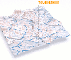 Places with similar names to Tol-e Meshkīn, Iran :: Disclaimer :: Information on this page comes without warranty of any kind |
||
|
Where is Tol-e Meshkīn? Elevation and coordinates ::
Latitude (lat): 30°4'14"N Longitude (lon): 51°27'26"E
Elevation (approx.): 963m (map arrows pan, magnifying glasses zoom) |
||
|
Visiting Tol-e Meshkīn? Hotel/Accommodation ::
Book a hotel in Tol-e Meshkīn Travel Guide ::
Buy a travel guide for Iran rental cars ::
car rental offers GPS waypoint ::
download a GPX waypoint (PoI) of Tol-e Meshkīn for your GPS receiver
|
||