|
search place name
|
||
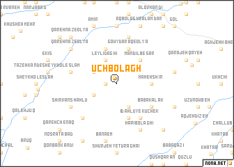
Ūch Bolāgh (Ostān-e Āz̄arbāyjān-e Sharqī, Iran)Ūch Bolāgh is a town in the Ostān-e Āz̄arbāyjān-e Sharqī region of Iran. An overview map of the region around Ūch Bolāgh is displayed below.
regional and 3d topo map of Ūch Bolāgh, Iran ::
Ūch Bolāgh airports ::
The nearest airport is TBZ - Tabriz Intl, located 102.0 km north of Ūch Bolāgh.
Other airports nearby include SDG - Sanandaj (227.8 km south), Nearby towns ::
Parchīn Bolāgh (1.5km west) //
Chālelū (3.5km north west) //
Nākherchī Bolāghī (3.5km south west) //
Leylī Dāghī (4.0km north) //
Āghcheh Mashhad-e Chahār Dowlī (4.0km south) //
Mandīl Besar (4.7km north east) //
Mameh Shīr (4.4km east) //
Īdahlū-ye Bozorg (5.8km south) //
Leylī Dāghī (5.8km north) //
Gowy Daraq-e ‘Olyā (5.8km north) //
Īdahlū-ye Kūchek (6.3km south east) //
Bābā Kalak (5.8km south east) //
Gowy Daraq-e Soflá (7.6km north) //
Dīzeh Dāghī (6.2km west) //
Āqmanār (7.1km south west) //
Hapībolāghī (8.0km south) //
Sārīqayeh (7.0km south west) //
ShīrvānShāhlū (7.0km south west) //
Tāzeh Kand-e Qarahnāz (8.1km north west) //
Qareh Nāz-e ‘Olyā (8.1km north west) //
Qareh Nāz-e ‘Olyā (9.5km north west) //
Āghcheh Mashhad-e Pasānlū (9.5km south east) //
[all distances 'as the bird flies' and approximate] 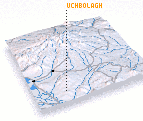 Places with similar names to Ūch Bolāgh, Iran ::
// Ūch Bolāgh (IR)
// Ūch Bolāgh (IR)
// Ūch Bolāgh (IR)
// Ūch Bolāgh (IR)
// Ūchbolāgh (IR)
// Ūchbolāgh (IR)
// Ūchbolāgh (IR)
// Ūch Bolāghī (IR)
Disclaimer :: Information on this page comes without warranty of any kind |
||
|
Where is Ūch Bolāgh? Elevation and coordinates ::
Latitude (lat): 37°13'0"N Longitude (lon): 46°18'0"E
Elevation (approx.): 1870m (map arrows pan, magnifying glasses zoom) |
||
|
Visiting Ūch Bolāgh? Hotel/Accommodation ::
Book a hotel in Ūch Bolāgh Travel Guide ::
Buy a travel guide for Iran rental cars ::
car rental offers GPS waypoint ::
download a GPX waypoint (PoI) of Ūch Bolāgh for your GPS receiver
|
||