|
search place name
|
||
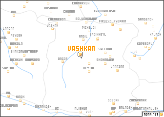
Vāshkan (Iran)Vāshkan is a town in Iran. An overview map of the region around Vāshkan is displayed below.
regional and 3d topo map of Vāshkan, Iran ::
Vāshkan airports ::
The nearest airport is THR - Teheran Mehrabad Intl, located 78.0 km south west of Vāshkan.
Other airports nearby include RZR - Ramsar (114.3 km north west), Nearby towns ::
Kangar (1.8km south east) //
Neytal (3.3km south east) //
Āngīl (4.2km north) //
Angās (3.6km west) //
Şāleḩān (4.5km east) //
Nājer-e Dasht-e Rūyān (4.5km east) //
Shāh Nājer (4.5km east) //
Sarīvdeh (5.2km north east) //
Hezār Khāl (5.2km north east) //
Badī‘ Kheyl (5.5km north east) //
Līgūsh (6.4km north) //
Kalnak (6.4km north) //
Pīchelow (6.4km north) //
Khāchak (5.2km east) //
Baldeh Kojūr (8.3km north) //
Varāzān (7.2km south east) //
Lāshak (8.6km north west) //
Chenār Bon (9.3km north west) //
Fīrūz Kolā-ye Pā'īn (9.5km north east) //
Fīrūz Kolā-ye Bālā (9.7km north east) //
[all distances 'as the bird flies' and approximate] 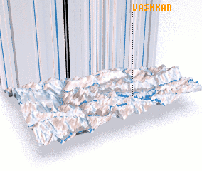 Places with similar names to Vāshkan, Iran ::
Disclaimer :: Information on this page comes without warranty of any kind |
||
|
Where is Vāshkan? Elevation and coordinates ::
Latitude (lat): 36°18'38"N Longitude (lon): 51°43'6"E
Elevation (approx.): 1774m (map arrows pan, magnifying glasses zoom) |
||
|
Visiting Vāshkan? Hotel/Accommodation ::
Book a hotel in Vāshkan Travel Guide ::
Buy a travel guide for Iran rental cars ::
car rental offers GPS waypoint ::
download a GPX waypoint (PoI) of Vāshkan for your GPS receiver
|
||