|
search place name
|
||
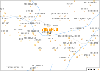
Yūseflū (Ostān-e Āz̄arbāyjān-e Sharqī, Iran)Yūseflū is a town in the Ostān-e Āz̄arbāyjān-e Sharqī region of Iran. An overview map of the region around Yūseflū is displayed below.
regional and 3d topo map of Yūseflū, Iran ::
Yūseflū airports ::
The nearest airport is TBZ - Tabriz Intl, located 98.6 km west of Yūseflū.
Nearby towns ::
Şafī Khānlū (0.0km north) //
Qal‘eh Bāshī (0.9km north west) //
Āllū (2.1km south) //
Kūsehlār (2.4km south east) //
Naqdūz (3.2km north) //
Mīzān (3.3km north east) //
Zahvar (4.3km south west) //
Mīrzānd (4.7km south east) //
Ḩeşār-e Seyyedlar (4.4km west) //
Yūzbāshlū (4.4km west) //
Seyyedlar (4.4km west) //
Olalū (5.7km south) //
Asar (4.8km west) //
Andāb-e Qadīm (4.9km west) //
Bohal (5.7km south west) //
Gūzvān-e Bozorg (5.7km south east) //
Zaglīk-e Kūrbolāgh (6.3km north east) //
Efīl (6.3km south west) //
Qarājehlū (5.7km north west) //
Tāzeh Kand-e Ḩājjīkhān (5.7km east) //
Gūzvān-e Kūchak (6.1km east) //
Andāb-e Jadīd (6.1km west) //
Kūr Bolāgh (7.1km north west) //
Pīeh Jīk-e ‘Olyā (6.9km south east) //
Qeshlāq-e Khīārlū (8.0km north) //
Nāz̧emābād (8.0km north) //
Sāţī-ye Soflá (6.7km east) //
Nīāz (6.8km east) //
Mastaleh (8.2km north west) //
[all distances 'as the bird flies' and approximate]  Places with similar names to Yūseflū, Iran ::
Disclaimer :: Information on this page comes without warranty of any kind |
||
|
Where is Yūseflū? Elevation and coordinates ::
Latitude (lat): 38°23'0"N Longitude (lon): 47°19'0"E
Elevation (approx.): 1138m (map arrows pan, magnifying glasses zoom) |
||
|
Visiting Yūseflū? Hotel/Accommodation ::
Book a hotel in Yūseflū Travel Guide ::
Buy a travel guide for Iran rental cars ::
car rental offers GPS waypoint ::
download a GPX waypoint (PoI) of Yūseflū for your GPS receiver
|
||