|
search place name
|
||
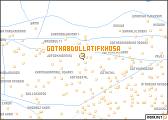
Goth Abdul Latīf Khosa (Sind, Pakistan)Goth Abdul Latīf Khosa is a town in the Sind region of Pakistan. An overview map of the region around Goth Abdul Latīf Khosa is displayed below.
regional and 3d topo map of Goth Abdul Latīf Khosa, Pakistan ::
Goth Abdul Latīf Khosa airports ::
The nearest airport is SUL - Sui, located 32.8 km north east of Goth Abdul Latīf Khosa.
Other airports nearby include SKZ - Sukkur (76.8 km south), RYK - Rahim Yar Khan Sheikh Zayed (124.0 km east), MJD - Moenjodaro (144.6 km south west), JSA - Jaisalmer (246.8 km south east), Nearby towns ::
Muhammad Hassan Bugti (0.7km south east) //
Goth Muhammad Amīn Khosa (0.8km north east) //
Tāj Sanirjāni (1.4km south west) //
Goth Mangar Hindu (1.5km north west) //
Goth Marān Jakrāni (1.5km north east) //
Sālgāni (2.2km south) //
Goth Gul Muhammad Bakrāni (2.9km south) //
Goth Fazal Muhammad Hayāt (3.0km south east) //
Goth Mewa Khān (3.4km north) //
Qubba Alam Shāh (3.7km north) //
Goth Takorla (3.8km north) //
Hazūr Bakhsh Gishkori (3.6km south east) //
Goth Ālam Khān (4.6km north) //
Goth Mehar Māri (4.4km south east) //
Goth Sefal (5.0km south) //
Goth Rāna Bhalo (5.0km south east) //
Jāfar Khān Rind (4.6km west) //
Dodo Bugti (5.3km north) //
Muhammadan (4.7km south west) //
Goth Dhoti (4.9km east) //
Goth Abdullah (5.8km south west) //
Goth Hīrapur (5.6km north east) //
Shanmbo Jakrāni (5.9km north west) //
Bahadur Khān Khosa (6.0km south west) //
Goth Karīm Bakhsh Khosa (6.6km south) //
Goth Chīl (6.3km south east) //
Sirājuddin (6.6km south west) //
Taj Muhammad Baqrāni (7.0km south) //
Goth Hakīm Khān Naunāri (7.1km south) //
[all distances 'as the bird flies' and approximate] 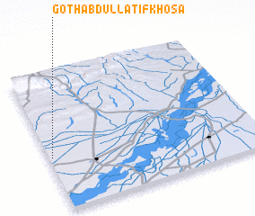 Places with similar names to Goth Abdul Latīf Khosa, Pakistan :: Disclaimer :: Information on this page comes without warranty of any kind |
||
|
Where is Goth Abdul Latīf Khosa? Elevation and coordinates ::
Latitude (lat): 28°23'10"N Longitude (lon): 69°0'50"E
Elevation (approx.): 65m (map arrows pan, magnifying glasses zoom) |
||
|
Visiting Goth Abdul Latīf Khosa? Hotel/Accommodation ::
Book a hotel in Goth Abdul Latīf Khosa Travel Guide ::
Buy a travel guide for Pakistan rental cars ::
car rental offers GPS waypoint ::
download a GPX waypoint (PoI) of Goth Abdul Latīf Khosa for your GPS receiver
|
||