|
search place name
|
||
Īslāmābād (Punjab, Pakistan)Īslāmābād is a town in the Punjab region of Pakistan. An overview map of the region around Īslāmābād is displayed below.
regional and 3d topo map of Īslāmābād, Pakistan ::

Īslāmābād airports ::
The nearest airport is RYK - Rahim Yar Khan Sheikh Zayed, located 24.2 km south west of Īslāmābād.
Other airports nearby include SUL - Sui (122.3 km west), SKZ - Sukkur (185.3 km south west), JSA - Jaisalmer (190.4 km south), MUX - Multan Intl (206.1 km north east), Nearby towns ::
Bhūt Jām Guldār (0.3km south west) //
Kot Kaptānwāla (1.3km north) //
Chak Samān (1.5km west) //
Bāgu (2.1km east) //
Basti Īse Bābāwāli (2.5km south) //
Yūsufnagar (2.6km north) //
Basti Rukan Dīnwāli (2.6km south) //
Basti Gul Muhammadwāli (2.8km south west) //
Chak Seventy-seven (2.8km north west) //
Wāhi Jumman Shāh (2.9km south east) //
Chak Eighty-two (3.0km north east) //
Shāh Muhammadwāla (2.9km west) //
Basti Mattu (3.4km north east) //
Basti Lohārānwāli (3.7km south) //
Tibbi Gul Muhammad (3.4km north east) //
Basti Ghulām Hussain (3.8km south) //
Basti Kumhār (3.4km north east) //
Basti Ahmad Hussain (3.8km south west) //
Basti Purāni (3.6km south east) //
Kāte da Khu (3.8km north east) //
Mad Muhammad Akbar Shāh (3.6km north east) //
Basti Mochiān (4.0km south) //
Chak Eighty-one (4.0km north east) //
Basti Chacharān (4.2km south) //
Basti Dhīm (4.3km south) //
Khu Gullan (4.3km north) //
Chak Seventy-five (4.3km north west) //
Basti Fāzil (4.6km south) //
Basti Manzūr Ahmad (4.7km south) //
[all distances 'as the bird flies' and approximate] 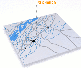 Places with similar names to Īslāmābād, Pakistan ::
Disclaimer :: Information on this page comes without warranty of any kind |
||
|
Where is Īslāmābād? Elevation and coordinates ::
Latitude (lat): 28°33'40"N Longitude (lon): 70°25'25"E
Elevation (approx.): 82m (map arrows pan, magnifying glasses zoom) |
||
|
Visiting Īslāmābād? Hotel/Accommodation ::
Book a hotel in Īslāmābād Travel Guide ::
Buy a travel guide for Pakistan rental cars ::
car rental offers GPS waypoint ::
download a GPX waypoint (PoI) of Īslāmābād for your GPS receiver
|
||