|
search place name
|
||
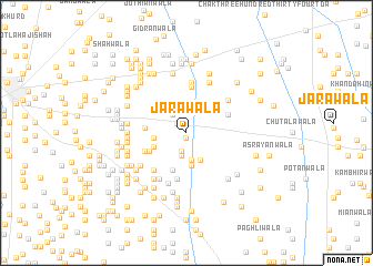
Jārawāla (Punjab, Pakistan)Jārawāla is a town in the Punjab region of Pakistan. An overview map of the region around Jārawāla is displayed below.
regional and 3d topo map of Jārawāla, Pakistan ::
Jārawāla airports ::
The nearest airport is MUX - Multan Intl, located 85.4 km south of Jārawāla.
Other airports nearby include PZH - Zhob (163.0 km west), LYP - Faisalabad Intl (187.7 km east), Nearby towns ::
Chak One Hundred Fifty-three A (0.5km south) //
Chak One Hundred Forty-two (1.2km north west) //
Chothiwāla (1.9km south) //
Chūrāwāla (2.2km north west) //
Chak One Hundred Fifty-three A (2.4km south) //
Lelwāla (2.8km south) //
Gattūwāla (3.0km south east) //
Mochīwāla (2.8km west) //
Hānswāla (3.3km south) //
Chak Two Hundred Fifty-four A (3.1km north east) //
Khalārwāla (3.1km south west) //
Nāgeruwāla (3.9km south) //
Chak One Hundred Forty-one (3.6km north west) //
Chak One Hundred Fifty-two B (3.7km south west) //
Kikrīwāla (3.6km west) //
Sādiawāla (4.0km south west) //
Chak Two Hundred Fifty-four (4.0km north east) //
Mīān Sāhibwāla (4.7km north) //
Chak One Hundred Fifty-six (4.7km south) //
Bāghwāla (4.7km south) //
Faqirwāla (4.6km south west) //
Chak One Hundred Thirty-three (5.1km north) //
Chak Two Hundred Seventy-eight (4.8km north east) //
Mahrawāla (5.2km south west) //
Nūrīwāla (5.3km south) //
Chak Two Hundred Seventy-nine (5.5km north) //
Taliwāla (5.4km south west) //
Shangrawāla (5.4km south west) //
Bāghwāla (5.1km south west) //
[all distances 'as the bird flies' and approximate]  Places with similar names to Jārawāla, Pakistan ::
Disclaimer :: Information on this page comes without warranty of any kind |
||
|
Where is Jārawāla? Elevation and coordinates ::
Latitude (lat): 30°55'15"N Longitude (lon): 71°5'45"E
Elevation (approx.): 146m (map arrows pan, magnifying glasses zoom) |
||
|
Visiting Jārawāla? Hotel/Accommodation ::
Book a hotel in Jārawāla Travel Guide ::
Buy a travel guide for Pakistan rental cars ::
car rental offers GPS waypoint ::
download a GPX waypoint (PoI) of Jārawāla for your GPS receiver
|
||