|
search place name
|
||
Kāmāro (Sind, Pakistan)Kāmāro is a town in the Sind region of Pakistan. An overview map of the region around Kāmāro is displayed below.
regional and 3d topo map of Kāmāro, Pakistan ::

Kāmāro airports ::
The nearest airport is BDN - Talhar, located 63.7 km east of Kāmāro.
Other airports nearby include KHI - Karachi Jinnah Intl (111.2 km west), WNS - Nawabshah (170.9 km north), BHJ - Bhuj (212.8 km south east), IXY - Kandla (257.7 km south east), Nearby towns ::
Larh Chārho (1.7km east) //
Mojiri (3.4km west) //
Liāri (3.7km south) //
Relo (4.1km north west) //
Sāmāni (4.1km north east) //
Jatoi (5.1km west) //
Bāmbato (5.6km north) //
Jhālo (5.4km west) //
Odeh Jāni (6.5km south west) //
Parhārki (6.5km north west) //
Jār (6.3km south west) //
Gap (6.3km north west) //
Mīrpur Batoro (6.5km north east) //
Khudi Dini (6.5km north east) //
Buddha Tālpur (7.4km south) //
Pirdino Sumro (7.0km west) //
Chhilriun (7.6km south) //
Dari (7.0km west) //
Odhejāni (8.1km south west) //
Chandia (7.7km south west) //
Kandra (8.7km south west) //
Bachal (8.7km south west) //
Karimpur (8.7km north west) //
Dādu (10.0km south west) //
Bābiri (10.0km south east) //
[all distances 'as the bird flies' and approximate] 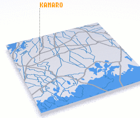 Places with similar names to Kāmāro, Pakistan ::
Disclaimer :: Information on this page comes without warranty of any kind |
||
|
Where is Kāmāro? Elevation and coordinates ::
Latitude (lat): 24°41'0"N Longitude (lon): 68°14'0"E
Elevation (approx.): 8m (map arrows pan, magnifying glasses zoom) |
||
|
Visiting Kāmāro? Hotel/Accommodation ::
Book a hotel in Kāmāro Travel Guide ::
Buy a travel guide for Pakistan rental cars ::
car rental offers GPS waypoint ::
download a GPX waypoint (PoI) of Kāmāro for your GPS receiver
|
||