|
search place name
|
||
Kot Kalāl (Punjab, Pakistan)Kot Kalāl is a town in the Punjab region of Pakistan. An overview map of the region around Kot Kalāl is displayed below.
regional and 3d topo map of Kot Kalāl, Pakistan ::

Kot Kalāl airports ::
The nearest airport is IXJ - Jammu, located 45.3 km north east of Kot Kalāl.
Other airports nearby include ATQ - Amritsar (71.6 km south), LHE - Lahore Allama Iqbal Intl (91.9 km south), IXP - Pathankot (98.1 km east), RAZ - Rawala Kot Rawalakot (184.1 km north west), Nearby towns ::
Dingrawāli (0.2km north east) //
Diālogha (1.3km north west) //
Dāogogha (1.9km north) //
Sohiān (1.7km east) //
Kot Dingrawāli (2.1km north east) //
Maitle (2.0km south east) //
Lawere (2.4km south west) //
Jhakkar (2.4km south east) //
Abdāli (2.4km south east) //
Nāthu Kāler (2.4km north west) //
Bathe (2.5km north east) //
Nake (2.4km east) //
Nawāda (2.9km north) //
Mānd (3.1km west) //
Dugri (3.1km west) //
Thatti (3.7km south) //
Godha (3.7km south) //
Sol (3.7km north) //
Kolpur (3.7km north) //
Pūrab (3.3km north east) //
Dehlum (3.8km north west) //
Judhāla (3.6km south west) //
Kamāla (3.6km south west) //
Salemeke (3.6km south east) //
Langen (3.6km south east) //
Randhāwa (4.0km south west) //
Karangali (4.0km south west) //
Panjgarain (3.6km north west) //
Panwāna (4.0km south east) //
[all distances 'as the bird flies' and approximate] 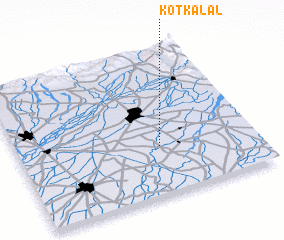 Places with similar names to Kot Kalāl, Pakistan ::
Disclaimer :: Information on this page comes without warranty of any kind |
||
|
Where is Kot Kalāl? Elevation and coordinates ::
Latitude (lat): 32°20'0"N Longitude (lon): 74°36'0"E
Elevation (approx.): 239m (map arrows pan, magnifying glasses zoom) |
||
|
Visiting Kot Kalāl? Hotel/Accommodation ::
Book a hotel in Kot Kalāl Travel Guide ::
Buy a travel guide for Pakistan rental cars ::
car rental offers GPS waypoint ::
download a GPX waypoint (PoI) of Kot Kalāl for your GPS receiver
|
||