|
search place name
|
||
Rāhmat Ali (Sind, Pakistan)Rāhmat Ali is a town in the Sind region of Pakistan. An overview map of the region around Rāhmat Ali is displayed below.
regional and 3d topo map of Rāhmat Ali, Pakistan ::

Rāhmat Ali airports ::
The nearest airport is WNS - Nawabshah, located 43.6 km south east of Rāhmat Ali.
Other airports nearby include MJD - Moenjodaro (90.5 km north), SKZ - Sukkur (149.5 km north east), BDN - Talhar (199.9 km south), KHI - Karachi Jinnah Intl (202.3 km south west), Nearby towns ::
Hidāyatullah Khokhar (0.4km south west) //
Subhānuddīn (0.5km south) //
Qāsim Shāh (0.8km north) //
Pitāliān (0.8km south west) //
Bachal Dāhri (1.2km south west) //
Chānda Singh (1.1km south east) //
Maulvi Muhammad Dāud (1.6km west) //
Ismāīl Wadero (1.7km north west) //
Ghulām Muhammad Arāīn (1.6km east) //
Soba Dāhri (2.5km south) //
Allāh Warāya Dāhri (2.3km south west) //
Ali Muhammad Arāīn (2.4km west) //
Ali Muhammad Gil (2.8km north) //
Maulvi Ismāīl (2.9km north) //
Goth Pahār (3.0km south west) //
Hāji Abdul Rauf (2.9km east) //
Panjba (3.5km south east) //
Dīna Baghio (3.5km north east) //
Tāru Dāhri (3.6km south west) //
Karam Ali (3.6km north east) //
Panjba (3.8km south east) //
Abdul Rahmān Dāhri (4.1km north west) //
Jalāl Dāhri (4.0km west) //
Wali Muhammad Khān Rind (4.5km south east) //
Kore Zardāri (4.2km west) //
Dhoro Fāl (4.2km east) //
Yūsaf Shāh (4.5km south west) //
Hāji Ismāīl (4.8km north) //
Muhammad Otha (4.4km south west) //
[all distances 'as the bird flies' and approximate] 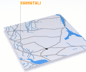 Places with similar names to Rāhmat Ali, Pakistan ::
// Rumah Dali (MY)
// Rumah Dulah (MY)
// Rumah Tali (MY)
// Rumah Tila (MY)
// Romedal (NO)
// Ramatale (ZA)
// Ramdolla (BF)
// Ramadilla (CL)
// Ramadala (CD)
// Rumitola (EC)
Disclaimer :: Information on this page comes without warranty of any kind |
||
|
Where is Rāhmat Ali? Elevation and coordinates ::
Latitude (lat): 26°31'10"N Longitude (lon): 68°6'25"E
Elevation (approx.): 41m (map arrows pan, magnifying glasses zoom) |
||
|
Visiting Rāhmat Ali? Hotel/Accommodation ::
Book a hotel in Rāhmat Ali Travel Guide ::
Buy a travel guide for Pakistan rental cars ::
car rental offers GPS waypoint ::
download a GPX waypoint (PoI) of Rāhmat Ali for your GPS receiver
|
||