|
search place name
|
||
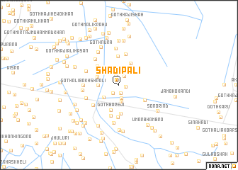
Shādīpali (Sind, Pakistan)Shādīpali is a town in the Sind region of Pakistan. An overview map of the region around Shādīpali is displayed below.
regional and 3d topo map of Shādīpali, Pakistan ::
Shādīpali airports ::
The nearest airport is BDN - Talhar, located 84.7 km south west of Shādīpali.
Other airports nearby include WNS - Nawabshah (114.9 km north west), JSA - Jaisalmer (222.9 km north east), MJD - Moenjodaro (229.0 km north west), Nearby towns ::
Goth Muhammad Qāsim Panwhar (0.7km north west) //
Goth Faqīr Muhammad (1.0km east) //
Goth Khuda Bakhsh Kario (1.4km south) //
Goth Bachu Panwhar (1.5km north) //
Goth Hāji Hāshim (1.6km south west) //
Lorha (1.6km north east) //
Goth Shafi Muhammad Panwhar (2.2km north) //
Goth Larke Khāskheli (2.2km south) //
Goth Muhammad Yāqūb Marri (2.7km south) //
Goth Faiz Muhammad (2.9km south west) //
Goth Faiz Muhammad Pali (2.9km west) //
Goth Piāro Panwhar (3.3km west) //
Purāni Shādipali (3.8km north east) //
Goth Dosu Wichla (3.8km north west) //
Goth Bāreji (4.2km south) //
Goth Hāji Pīr Shāh (4.5km north) //
Goth Urs Khān (4.2km north west) //
Goth Abdul Azīz Muhājir (4.6km south) //
Goth Fateh Muhammad Shar (4.5km south east) //
Goth Bijar Khān Baloch (4.9km north) //
Goth Bāreji (5.1km south) //
Goth Lāl Chand Bania (5.1km south) //
Goth Pīra Jān (4.9km south west) //
Khipri (5.2km north west) //
Goth Chhoto Pali (5.1km north west) //
Goth Mīr Muhammad Khān (5.1km south west) //
Goth Ali Bakhsh Pali (5.0km west) //
Goth Wali Muhammad Mangario (5.7km north) //
Goth Faqīr Muhammad Pali (5.2km west) //
[all distances 'as the bird flies' and approximate] 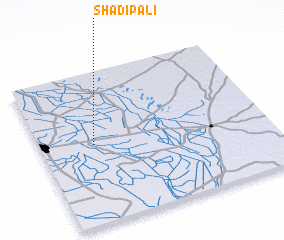 Places with similar names to Shādīpali, Pakistan ::
// Chhota Pāila (BD)
// Chhota Pauli (BD)
// Shatapali (EC)
// Chaudepalle (IN)
// Shetpalli (IN)
// Chhatto Pali (PK)
// Chitta Pail (PK)
// Shudo Paila (PK)
// Chã de Paulo (CV)
// Chutupālu (IN)
Disclaimer :: Information on this page comes without warranty of any kind |
||
|
Where is Shādīpali? Elevation and coordinates ::
Latitude (lat): 25°31'0"N Longitude (lon): 69°14'0"E
Elevation (approx.): 12m (map arrows pan, magnifying glasses zoom) |
||
|
Visiting Shādīpali? Hotel/Accommodation ::
Book a hotel in Shādīpali Travel Guide ::
Buy a travel guide for Pakistan rental cars ::
car rental offers GPS waypoint ::
download a GPX waypoint (PoI) of Shādīpali for your GPS receiver
|
||