|
search place name
|
||
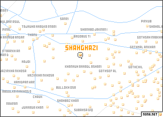
Shāh Ghazi (Sind, Pakistan)Shāh Ghazi is a town in the Sind region of Pakistan. An overview map of the region around Shāh Ghazi is displayed below.
regional and 3d topo map of Shāh Ghazi, Pakistan ::
Shāh Ghazi airports ::
The nearest airport is SUL - Sui, located 37.0 km north east of Shāh Ghazi.
Other airports nearby include SKZ - Sukkur (74.3 km south), RYK - Rahim Yar Khan Sheikh Zayed (130.3 km east), MJD - Moenjodaro (140.2 km south west), JSA - Jaisalmer (250.9 km south east), Nearby towns ::
Jāfar Khān Rind (1.8km north east) //
Muhammadan (2.1km south east) //
Khān Muhammad Lāshāri (3.0km south) //
Yāro Khosa (3.3km north west) //
Budhar Wānio (3.5km north west) //
Bahadur Khān Khosa (3.8km south east) //
Dāim (3.8km north west) //
Bago Bugti (4.0km north) //
Fateh Khān (4.1km south) //
Abdullah Jakrāni (3.8km north west) //
Lashāri (4.4km north west) //
Hāji Faiz Muhammad (4.5km south west) //
Samad Khān Bugti (5.2km north) //
Sher Ali (5.2km south) //
Sirājuddin (5.4km south east) //
Tāj Sanirjāni (5.2km east) //
Goth Abdullah (5.8km south east) //
Bāri (5.9km south west) //
Shanmbo Jakrāni (6.1km north east) //
Goth Gul Muhammad Bakrāni (5.7km east) //
Miro Khān Jakrāni (5.7km west) //
Goth Mangar Hindu (5.8km east) //
Toto Gashkori (6.1km west) //
Qubba Alam Shāh (6.5km north east) //
Goth Abdul Latīf Khosa (6.3km east) //
Kundha Baqrāni (7.0km south east) //
Goth Jānib Khān (7.1km south) //
Wali Dād Khosa (6.7km south west) //
Goth Sefal (6.8km south east) //
[all distances 'as the bird flies' and approximate] 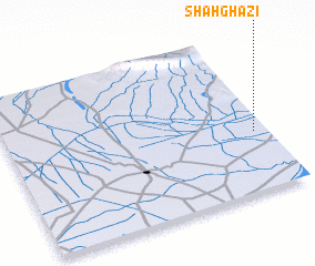 Places with similar names to Shāh Ghazi, Pakistan ::
Disclaimer :: Information on this page comes without warranty of any kind |
||
|
Where is Shāh Ghazi? Elevation and coordinates ::
Latitude (lat): 28°22'40"N Longitude (lon): 68°57'0"E
Elevation (approx.): 65m (map arrows pan, magnifying glasses zoom) |
||
|
Visiting Shāh Ghazi? Hotel/Accommodation ::
Book a hotel in Shāh Ghazi Travel Guide ::
Buy a travel guide for Pakistan rental cars ::
car rental offers GPS waypoint ::
download a GPX waypoint (PoI) of Shāh Ghazi for your GPS receiver
|
||