|
search place name
|
||
Udharwāl (Punjab, Pakistan)Udharwāl is a town in the Punjab region of Pakistan. An overview map of the region around Udharwāl is displayed below.
regional and 3d topo map of Udharwāl, Pakistan ::

Udharwāl airports ::
The nearest airport is ISB - Islamabad Chaklala, located 80.8 km north of Udharwāl.
Other airports nearby include RAZ - Rawala Kot Rawalakot (137.7 km north east), PEW - Peshawar Intl (167.7 km north west), MFG - Muzaffarabad (169.2 km north east), LYP - Faisalabad Intl (174.9 km south), Nearby towns ::
Dhakku (3.7km north) //
Murīd (5.0km west) //
Sadwāl (6.4km south east) //
Mengan (6.0km north west) //
Chakwāl (6.2km east) //
Tatrāl (6.5km east) //
Laliānwāli (7.7km north) //
Mohra Thanīl (7.3km south east) //
Sutwāl (7.2km south east) //
Joya Māir (8.4km north) //
Janga (8.8km south east) //
Bhaun (8.8km south west) //
Thathi (8.8km south east) //
Mohra Lohārān (9.0km north east) //
Vairo (9.4km north west) //
Dhāb (9.7km north east) //
[all distances 'as the bird flies' and approximate] 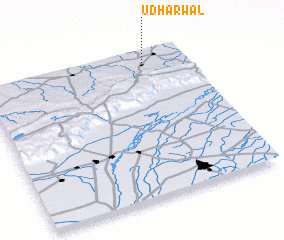 Places with similar names to Udharwāl, Pakistan :: Disclaimer :: Information on this page comes without warranty of any kind |
||
|
Where is Udharwāl? Elevation and coordinates ::
Latitude (lat): 32°56'0"N Longitude (lon): 72°48'0"E
Elevation (approx.): 532m (map arrows pan, magnifying glasses zoom) |
||
|
Visiting Udharwāl? Hotel/Accommodation ::
Book a hotel in Udharwāl Travel Guide ::
Buy a travel guide for Pakistan rental cars ::
car rental offers GPS waypoint ::
download a GPX waypoint (PoI) of Udharwāl for your GPS receiver
|
||