|
search place name
|
||
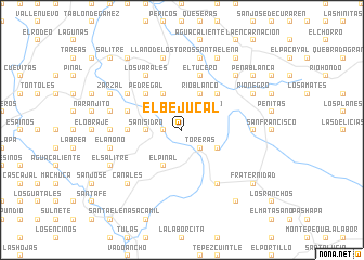
El Bejucal (Ocotepeque, Honduras)El Bejucal is a town in the Ocotepeque region of Honduras. An overview map of the region around El Bejucal is displayed below.
regional and 3d topo map of El Bejucal, Honduras ::
El Bejucal airports ::
The nearest airport is SAL - San Salvador El Salvador Intl, located 126.8 km south of El Bejucal.
Other airports nearby include GUA - Guatemala City La Aurora (148.4 km west), SAP - San Pedro Sula La Mesa Intl (163.2 km north east), CBV - Coban (166.9 km north west), TGU - Tegucigalpa Toncontin Intl (216.4 km east), Nearby towns ::
La Rinconada (1.8km west) //
Plan Grande (1.8km west) //
Chuctal (1.8km west) //
El Encumbrado (1.9km north) //
Encumbrada (1.9km north) //
Las Toreras (2.6km south east) //
Toreras (2.6km south east) //
Aradona (2.6km north west) //
San Jerónimo (2.6km north east) //
San Isidro (3.6km west) //
El Hormiguero (4.0km south east) //
El Pinal (4.1km south west) //
El Río Blanco (4.0km north east) //
Cafetales (4.1km north west) //
Río Blanco (4.1km north east) //
Loma Alta (5.2km north west) //
Pedregal (5.2km north west) //
Las Pozas (5.2km north west) //
Los Planes (5.2km north east) //
Valle de Jesús (5.4km west) //
Malcotal (5.7km west) //
El Tucero (5.8km north) //
Los Varales (6.6km north west) //
Dolores (6.6km south east) //
Chanmagua (6.5km north west) //
Las Cruces (7.2km east) //
Guineal (7.2km west) //
El Anono (7.4km west) //
Llano de los Toros (7.6km north) //
[all distances 'as the bird flies' and approximate]  Places with similar names to El Bejucal, Honduras ::
// El Bejucal (PA)
// El Bejucal (GT)
// El Bijagual (GT)
// El Bijagual (GT)
// El Bejucal (MX)
// El Bejucal (MX)
// El Bejucal (MX)
// El Bejucal (HN)
// El Bijagual (HN)
// El Bejucal (VE)
Disclaimer :: Information on this page comes without warranty of any kind |
||
|
Where is El Bejucal? Elevation and coordinates ::
Latitude (lat): 14°35'0"N Longitude (lon): 89°9'0"W
Elevation (approx.): 1765m (map arrows pan, magnifying glasses zoom) |
||
|
Visiting El Bejucal? Hotel/Accommodation ::
Book a hotel in El Bejucal Travel Guide ::
Buy a travel guide for Honduras rental cars ::
car rental offers GPS waypoint ::
download a GPX waypoint (PoI) of El Bejucal for your GPS receiver
|
||