|
search place name
|
||
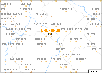
La Cañada (Francisco Morazán, Honduras)La Cañada is a town in the Francisco Morazán region of Honduras. An overview map of the region around La Cañada is displayed below.
regional and 3d topo map of La Cañada, Honduras ::
La Cañada airports ::
The nearest airport is TGU - Tegucigalpa Toncontin Intl, located 69.0 km south of La Cañada.
Other airports nearby include SAP - San Pedro Sula La Mesa Intl (116.5 km north west), LCE - La Ceiba Goloson Intl (122.5 km north), TEA - Tela (124.9 km north), RTB - Roatan Juan Manuel Galvez Intl (194.1 km north), Nearby towns ::
Buenas Noches (0.0km north) //
El Chorro (0.0km north) //
El Cordoncillo (0.0km north) //
La Majada (0.0km north) //
El Montarrón (0.0km north) //
El Palmar (0.0km north) //
San Francisco (0.0km north) //
Portillo Grande (0.0km north) //
Montecillos (0.0km north) //
El Rodeo (0.0km north) //
Las Uvas (0.0km north) //
La Camelia (0.0km north) //
Aserradero Miravalles (1.8km west) //
Tapalito (2.6km south east) //
Miravalles (4.0km south west) //
El Terrero (4.1km north east) //
Siria (5.2km south east) //
La Higuera (5.2km south west) //
El Quebrachal (5.2km north west) //
Pueblo Nuevo (5.7km east) //
Santa Rosa (6.6km south east) //
El Porvenir (7.4km north) //
Moya (7.4km east) //
El Pedernal (7.4km east) //
El Higuerito (8.2km south east) //
Mezcales (8.2km north west) //
Las Crucitas (9.2km south east) //
Sicaguara Abajo (9.2km south east) //
Los Pirineos (9.1km south east) //
[all distances 'as the bird flies' and approximate]  Places with similar names to La Cañada, Honduras ::
Disclaimer :: Information on this page comes without warranty of any kind |
||
|
Where is La Cañada? Elevation and coordinates ::
Latitude (lat): 14°41'0"N Longitude (lon): 87°11'0"W
Elevation (approx.): 616m (map arrows pan, magnifying glasses zoom) |
||
|
Visiting La Cañada? Hotel/Accommodation ::
Book a hotel in La Cañada Travel Guide ::
Buy a travel guide for Honduras rental cars ::
car rental offers GPS waypoint ::
download a GPX waypoint (PoI) of La Cañada for your GPS receiver
|
||