|
search place name
|
||
Laguna Verde (Santa Bárbara, Honduras)Laguna Verde is a town in the Santa Bárbara region of Honduras. An overview map of the region around Laguna Verde is displayed below.
regional and 3d topo map of Laguna Verde, Honduras ::

Laguna Verde airports ::
The nearest airport is SAP - San Pedro Sula La Mesa Intl, located 67.4 km east of Laguna Verde.
Other airports nearby include TEA - Tela (122.0 km east), LCE - La Ceiba Goloson Intl (185.6 km east), CBV - Coban (199.4 km west), TGU - Tegucigalpa Toncontin Intl (207.2 km south east), Nearby towns ::
El Jute (1.7km south east) //
Culupa (1.9km south east) //
Loma Alta (2.0km south west) //
La Moroca (2.2km north) //
La Divisioria (2.9km north) //
El Jícaro (3.0km south) //
Galápagos (3.1km north east) //
Tintines (3.7km south east) //
Piedra Larga (4.3km south) //
La Joya (4.3km south) //
La Puerta (4.4km south east) //
El Gavilán (4.5km east) //
La Esperancita (4.5km west) //
Cerro Grande (4.7km south west) //
Teocintales (4.8km north east) //
El Higueral (5.0km north east) //
Cerro Corralito (4.9km west) //
Maguellalez (5.3km south east) //
Mezcales (5.6km south) //
Camalote (5.6km south) //
Merendoncito (6.0km west) //
Carrizal (6.3km south) //
Las Flores (6.1km west) //
Caobanal (6.2km south west) //
San Antonio (6.3km south west) //
La Joya del Vénado (6.7km south) //
El Limón (6.8km south west) //
Los Guinéos (7.1km south) //
Potreritos (7.2km south) //
[all distances 'as the bird flies' and approximate] 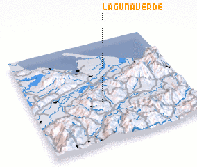 Places with similar names to Laguna Verde, Honduras ::
// Laguna Verde (CL)
// Laguna Verde (CO)
// Laguna Verde (GT)
// Laguna Verde (MX)
// Laguna Verde (MX)
// Laguna Verde (MX)
// Laguna Verde (MX)
// Laguna Verde (MX)
// Laguna Verde (MX)
// Laguna Verde (HN)
Disclaimer :: Information on this page comes without warranty of any kind |
||
|
Where is Laguna Verde? Elevation and coordinates ::
Latitude (lat): 15°24'43"N Longitude (lon): 88°33'0"W
Elevation (approx.): 509m (map arrows pan, magnifying glasses zoom) |
||
|
Visiting Laguna Verde? Hotel/Accommodation ::
Book a hotel in Laguna Verde Travel Guide ::
Buy a travel guide for Honduras rental cars ::
car rental offers GPS waypoint ::
download a GPX waypoint (PoI) of Laguna Verde for your GPS receiver
|
||