|
search place name
|
||
San Diego (El Paraíso, Honduras)San Diego is a town in the El Paraíso region of Honduras. An overview map of the region around San Diego is displayed below.
regional and 3d topo map of San Diego, Honduras ::

San Diego airports ::
The nearest airport is TGU - Tegucigalpa Toncontin Intl, located 81.1 km west of San Diego.
Other airports nearby include LCE - La Ceiba Goloson Intl (191.8 km north), MGA - Managua Intl (213.6 km south), TEA - Tela (219.7 km north west), SAP - San Pedro Sula La Mesa Intl (220.7 km north west), Nearby towns ::
Soledad (1.8km west) //
El Benque (1.9km south) //
El Porvenir (2.6km south east) //
Las Horquetas (3.7km south) //
La Hoya (4.1km south west) //
La Selva (4.1km south east) //
San José (5.2km south west) //
San Antonio (5.7km east) //
El Zarzal (6.6km north east) //
El Obraje (6.6km south east) //
La Lima (7.4km west) //
Asturias (7.4km west) //
Santa Elena (7.6km north) //
Oculi (7.7km north east) //
El Estero (9.1km south east) //
San Pedro (9.1km south east) //
Jutiapa (10.3km south east) //
[all distances 'as the bird flies' and approximate] 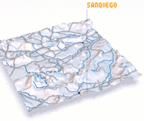 Places with similar names to San Diego, Honduras ::
Disclaimer :: Information on this page comes without warranty of any kind |
||
|
Where is San Diego? Elevation and coordinates ::
Latitude (lat): 14°3'0"N Longitude (lon): 86°28'0"W
Elevation (approx.): 585m (map arrows pan, magnifying glasses zoom) |
||
|
Visiting San Diego? Hotel/Accommodation ::
Book a hotel in San Diego Travel Guide ::
Buy a travel guide for Honduras rental cars ::
car rental offers GPS waypoint ::
download a GPX waypoint (PoI) of San Diego for your GPS receiver
|
||