|
search place name
|
||
Ash Shaqqī (Jādū, Libya)Ash Shaqqī is a town in the Jādū region of Libya. An overview map of the region around Ash Shaqqī is displayed below.
regional and 3d topo map of Ash Shaqqī, Libya ::

Ash Shaqqī airports ::
The nearest airport is TIP - Tripoli Intl, located 125.2 km north east of Ash Shaqqī.
Other airports nearby include DJE - Djerba Zarzis (241.2 km north west), GAE - Gabes (278.6 km north west), Nearby towns ::
Ţarmīşah (3.1km west) //
Tardīyah (3.6km south east) //
Awlād Mas‘ūd (4.9km south east) //
Awlād ‘Inān (6.6km east) //
Awlād ‘Abd al Jalīl (7.3km south east) //
Jannāwan (7.3km south west) //
Bū Jabalayn (7.3km south west) //
Ash Shabārī (7.3km south west) //
Al Quşayr (7.3km south west) //
Jādū (8.4km south west) //
Awlād Jābir (8.4km south east) //
Qaryat Mazzū (9.7km south west) //
[all distances 'as the bird flies' and approximate] 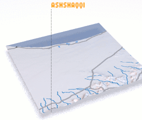 Places with similar names to Ash Shaqqī, Libya ::
// Ash Shakk (IQ)
// Ash Shawkā (EG)
// Ash Shawkah (EG)
// Ash Shawkah (EG)
// Ash Shuqqah (EG)
// Ash Shaykh (SA)
// Ash Shiqqah (SA)
// Ash Shaqq (SD)
// Ash Shaq‘ah (YE)
// Achachka (MA)
Disclaimer :: Information on this page comes without warranty of any kind |
||
|
Where is Ash Shaqqī? Elevation and coordinates ::
Latitude (lat): 32°0'0"N Longitude (lon): 12°5'0"E
Elevation (approx.): 700m (map arrows pan, magnifying glasses zoom) |
||
|
Visiting Ash Shaqqī? Hotel/Accommodation ::
Book a hotel in Ash Shaqqī Travel Guide ::
Buy a travel guide for Libya rental cars ::
car rental offers GPS waypoint ::
download a GPX waypoint (PoI) of Ash Shaqqī for your GPS receiver
|
||