|
search place name
|
||
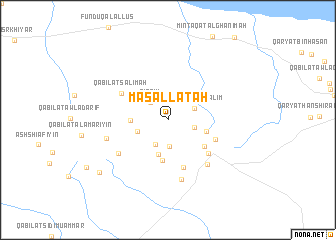
Masallātah (Libya)Masallātah is a town in Libya. An overview map of the region around Masallātah is displayed below.
regional and 3d topo map of Masallātah, Libya ::
Masallātah airports ::
The nearest airport is TIP - Tripoli Intl, located 79.1 km west of Masallātah.
Nearby towns ::
Qirrīm (2.6km north west) //
Minţaqat Zāwiyat Sīdī ‘Aţīyah (2.9km south) //
Qabīlat Indārah (2.6km east) //
Zāwiyat al ‘Amārīyīn (3.0km south) //
Qabīlat Banī Salīm (2.8km north east) //
Qabīlat ash Shurfah (3.2km south west) //
Qabīlat al Qalīl (3.9km south) //
Qabīlat al Karāwinah (3.5km west) //
Qabīlat Banī Musallam (3.8km east) //
Minţaqat Zāwiyat as Samāḩ (4.5km south) //
Qabīlat Za‘farān (4.5km south east) //
Qabīlat Banī Layth (5.5km south) //
Qaryat Banī Musallam (5.0km south east) //
Al Qaşabāt (5.3km south east) //
Qabīlat Salimah (5.3km north west) //
Qabīlat Wādinah (6.2km south east) //
Ash Shurūf (6.0km south west) //
Qabīlat Lawātah (6.8km south) //
Qabīlat ar Radādah (6.2km west) //
Qabīlat al Fawātīr (8.7km south west) //
[all distances 'as the bird flies' and approximate]  Places with similar names to Masallātah, Libya ::
Disclaimer :: Information on this page comes without warranty of any kind |
||
|
Where is Masallātah? Elevation and coordinates ::
Latitude (lat): 32°37'0"N Longitude (lon): 14°0'0"E
Elevation (approx.): 246m (map arrows pan, magnifying glasses zoom) |
||
|
Visiting Masallātah? Hotel/Accommodation ::
Book a hotel in Masallātah Travel Guide ::
Buy a travel guide for Libya rental cars ::
car rental offers GPS waypoint ::
download a GPX waypoint (PoI) of Masallātah for your GPS receiver
|
||