|
search place name
|
||
Huarao Alto (Piura, Peru)Huarao Alto is a town in the Piura region of Peru. An overview map of the region around Huarao Alto is displayed below.
regional and 3d topo map of Huarao Alto, Peru ::

Huarao Alto airports ::
The nearest airport is PIU - Piura Capitan Fap Guillermo Concha Iberico, located 55.7 km south west of Huarao Alto.
Other airports nearby include TYL - Talara Capitan Montes (121.3 km west), TBP - Tumbes Pedro Canga (151.0 km north), MCH - Machala General Manuel Serrano (183.3 km north), CIX - Chiclayo Capt Jose A Quinones Gonzales Intl (212.2 km south), Nearby towns ::
Pueblo Nuevo (0.6km south east) //
Pueblo Nuevo (1.5km south west) //
Huarao Bajo (3.3km south west) //
Totoral (4.1km north) //
Totora (4.5km north) //
Pueblo Libre (4.7km south west) //
Tinajones (5.3km east) //
Malingas (5.9km south west) //
Miraflores (6.0km north east) //
Tejedores (6.5km north) //
Palo Parado (6.8km west) //
Cruce de Vega (6.8km south west) //
La Puerta (6.9km south east) //
Palomino (6.9km south west) //
Miraflores (7.1km north east) //
Señor Cautivo (7.2km south west) //
El Convento (7.4km south east) //
Palonegro (7.4km south east) //
San Pedrillo (7.5km west) //
Valientes (8.1km south east) //
Las Mónicas (8.2km west) //
Cesteadero (8.4km north east) //
Puerta de Sancor (8.6km south) //
Santa Rosa de Yarachi (8.6km north) //
Santa Angélica (8.7km south west) //
Arguelles (8.7km east) //
Leones (8.9km north) //
Platillos (9.2km south) //
Sancor (9.6km south east) //
[all distances 'as the bird flies' and approximate] 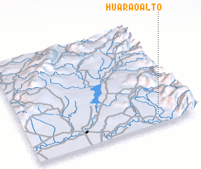 Places with similar names to Huarao Alto, Peru ::
Disclaimer :: Information on this page comes without warranty of any kind |
||
|
Where is Huarao Alto? Elevation and coordinates ::
Latitude (lat): 4°54'26"S Longitude (lon): 80°12'41"W
Elevation (approx.): 104m (map arrows pan, magnifying glasses zoom) |
||
|
Visiting Huarao Alto? Hotel/Accommodation ::
Book a hotel in Huarao Alto Travel Guide ::
Buy a travel guide for Peru rental cars ::
car rental offers GPS waypoint ::
download a GPX waypoint (PoI) of Huarao Alto for your GPS receiver
|
||