|
search place name
|
||
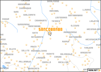
Sanco Bamba (La Libertad, Peru)Sanco Bamba is a town in the La Libertad region of Peru. An overview map of the region around Sanco Bamba is displayed below.
regional and 3d topo map of Sanco Bamba, Peru ::
Sanco Bamba airports ::
The nearest airport is JJI - Juanjui, located 134.1 km north east of Sanco Bamba.
Other airports nearby include TRU - Trujillo Capitan Carlos Martinez De Pinillos (148.0 km west), CHH - Chachapoyas (164.4 km north), CHM - Chimbote Teniente Jaime A De Montreuil Morales (179.0 km south west), ATA - Anta Comandante Fap German Arias Graziani (185.3 km south), Nearby towns ::
Llaman (1.0km south) //
Hacienda Santa Rosa (2.1km north west) //
Uchuy (3.7km north) //
Chillin (4.2km north east) //
Chirimoyo (4.2km south west) //
Cashahuate (4.6km north west) //
Tayanco (5.0km north) //
Nayguapata (5.1km west) //
Shita (5.7km west) //
Manancanchu (5.9km north east) //
Machay (5.9km south west) //
Gansul (5.9km east) //
Cashahuate (6.1km north west) //
Pur Pur (6.4km south east) //
Shita (6.5km west) //
Maraybamba (6.5km north west) //
Paccha Grande (7.1km south west) //
Cacho (7.1km east) //
Los Togames (7.1km north east) //
Pampa Grande (7.2km east) //
Mushite (7.5km south) //
Parva del Cerro (7.7km south west) //
Pauca (7.9km south west) //
Sequión (8.0km south) //
Hacienda Marcabal (8.2km north) //
Marcabal (8.5km north) //
Cachipampa (8.5km south east) //
Licame (8.9km south) //
Cangao (9.1km south) //
[all distances 'as the bird flies' and approximate]  Places with similar names to Sanco Bamba, Peru ::
// Suangbem (MM)
// Sanga-Bamba (CD)
// Sungaibambu (ID)
// Sungaibambu (ID)
// Sangoua Boma (GA)
// Sanquibamba (PE)
// Sangabama (NG)
// Zangbiama (LR)
// Sangbamba (SL)
// Sangbamba (SL)
Disclaimer :: Information on this page comes without warranty of any kind |
||
|
Where is Sanco Bamba? Elevation and coordinates ::
Latitude (lat): 7°41'16"S Longitude (lon): 77°49'35"W
Elevation (approx.): 2696m (map arrows pan, magnifying glasses zoom) |
||
|
Visiting Sanco Bamba? Hotel/Accommodation ::
Book a hotel in Sanco Bamba Travel Guide ::
Buy a travel guide for Peru rental cars ::
car rental offers GPS waypoint ::
download a GPX waypoint (PoI) of Sanco Bamba for your GPS receiver
|
||