|
search place name
|
||
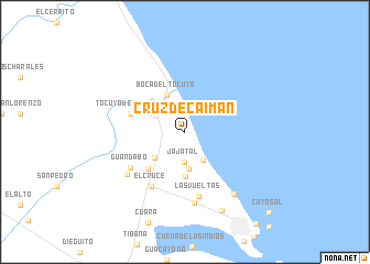
Cruz de Caimán (Falcón, Venezuela)Cruz de Caimán is a town in the Falcón region of Venezuela. An overview map of the region around Cruz de Caimán is displayed below.
regional and 3d topo map of Cruz de Caimán, Venezuela ::
Cruz de Caimán airports ::
The nearest airport is PBL - Puerto Cabello General Bartolome Salom Intl, located 65.8 km south east of Cruz de Caimán.
Other airports nearby include SFH - San Felipe Sub Teniente Nestor Arias (93.8 km south west), VLN - Valencia Arturo Michelena Intl (105.6 km south east), BON - Kralendijk Flamingo (123.5 km north), CUR - Willemstad Hato (146.6 km north west), Nearby towns ::
Jajatal (3.1km south) //
Empalizadas (3.3km south east) //
Mata Seca (3.8km south) //
Chivare (3.9km south west) //
Boca del Tocuyo (4.1km north west) //
El Taque (4.6km south) //
Blanquillo (5.2km south west) //
Tocuyo de La Costa (5.8km west) //
El Cruce (6.5km south west) //
Guandabo (6.5km south west) //
Las Vueltas (6.7km south) //
Flamenco (7.2km south) //
El Marite (7.2km south west) //
La Hacienda (8.0km south east) //
El Pasadero (8.8km south east) //
Cayo Sal (11.7km south east) //
[all distances 'as the bird flies' and approximate] 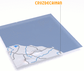 Places with similar names to Cruz de Caimán, Venezuela ::
// Krustakmeni (LV)
Disclaimer :: Information on this page comes without warranty of any kind |
||
|
Where is Cruz de Caimán? Elevation and coordinates ::
Latitude (lat): 11°1'0"N Longitude (lon): 68°20'0"W
Elevation (approx.): 7m (map arrows pan, magnifying glasses zoom) |
||
|
Visiting Cruz de Caimán? Hotel/Accommodation ::
Book a hotel in Cruz de Caimán Travel Guide ::
Buy a travel guide for Venezuela rental cars ::
car rental offers GPS waypoint ::
download a GPX waypoint (PoI) of Cruz de Caimán for your GPS receiver
|
||